
Since the first arrival of modern man, the South Downs and Blackcap in particular have changed considerably. When humans first arrived, after the last ice age, the Downs were covered by forests, principally made up of Small-leaved Lime. Mankind began to clear the forests and make his home on the chalk hills. He found fertile soils in the dry valleys and learned how to turn them with rudimentary tools. He began to plant arable crops and settled down to tend them. Around him, he took what nature provided and tamed and domesticated the flora and fauna available to him. As time went on and his skills increased, he made tools of flint and bone and decorated beakers by impressing them with combs. Art flourished at Ashcombe Bottom. Eventually he discovered bronze and developed even greater capacity to farm and hunt. He built barrows to honour the dead along the ridge of the Downs and he scraped them clean to the white chalk to show his power to others.
The Romano British grew crops in the lower chalk and grazed their sheep on the Downs. Shepherd s would drive their flocks onto the arable fields at night, folding them there so that their manure would enrich the land. He created trackways called Bostalls that wore ever deeper into the face of the North Scarp of the Downs. The sheep stripped the nutrients from the Downs and released them in the Weald. The Downs grew ever more diverse in their flora as each plant sought its niche. In Anglo Saxon times, he moved down from the hills and onto the lower chalk at the foot of the scarp. He built villages and churches, many of which still exist today and he cleared the Wealden forests and planted his crops there, tilling the heavy clay with his new iron ploughs.
As civilisation grew below, the sheep continued their steady work. The soil of the Downs grew ever poorer as their owners grew richer from the wool trade. By the eighteenth century it was believed that a man could walk from Winchester to Eastbourne on the backs of the sheep, which seems a slightly peculiar thing to want to do.
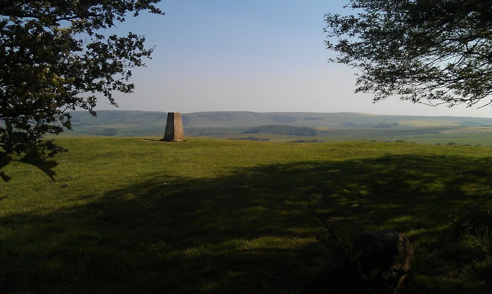
At some point a mill named Blackcap Mill had been present on the site. It is not known if the Mill were named after the hill or vice versa.
In the 1830s someone planted a copse of trees on top of Blackcap. It may (as local folklore suggests) have been intended as a guide for smugglers, or it may have been planted to celebrate the coronation of a new queen, Victoria. Certainly it seems to have been replanted in honour of our own Queen Elizabeth II.

Between these two queens, something happened to the Downs and to the world. With easier and cheaper transportation about the surface of the globe, sheep could be more inexpensively reared in New Zealand than on the South Downs. With ever better fertilisers available commercially, no-one needed to fold sheep on their fields at night. Sheep farming declined and with the introduction of myxomatosis, even rabbits stopped grazing the tender shoots on the hills. Hawthorn, Sycamore and Ash began to encroach on the rich grasslands.
World wars broke out and people needed food. Ploughs were used on the downs. Hundreds of archaeological features were destroyed and thousands of acres of four thousand year old, herb rich grassland was lost. Even as late as the 1980s, ploughs were used between Blackcap and Ashcombe Bottom. The improved soil favoured larger, more aggressive plants and the old downland plants could no longer compete. Many would never recover.
Hope existed, though. On the top of the ridge, where the ploughs never reached, rare and wonderful plants clung on, waiting for better times. In 1993, Blackcap was bought by the National Trust. The surviving remnants were protected, the encroaching trees checked and sheep returned to work their patient magic on the grassland.
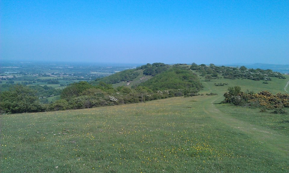
An aerial photograph taken in 1991 shows a divided hill top, A rich green showing to the south of the path and older, paler greens to the north. Today, with careful management it is hard to tell the difference with first glance. The rare plants too are coming back to their old territory.
Blackcap is a rare and important area on the South Downs. Chalk downland is internationally rare and sites like Blackcap are invaluable for preserving plants and animals that would otherwise suffer terribly in this modern world.
So what of the future? Ostensibly, the protection offered by National Trust ownership should allow areas such as Blackcap to flourish, free from harm. In reality, the truth may be rather different.
With rising sea levels and an increasing population, the pressure to build on higher areas like the Downs, or, possibly plough them up once more, may become too high. Human needs will always be placed above those of wildlife by human policy makers. What will become of the Downs once the Weald has turned to sea?
A Quick Note on Names
The original name of Blackcap appears to have been Mount Harry, while the hill now known as Mount Harry was called Lewes Beacon. Local folklore has it that Henry III stationed his troops on Mount Harry (Blackcap) during the Battle of Lewes 1264, but this is dismissed by Dimmock, Col (1934) as being impractical considering how the battle with Simon de Montfort played out.
Nevertheless, this appears to be where the hill acquired its name. At some point Lewes Beacon (where a replica beacon stands today) became known as Mount Harry and Blackcap gained its contemporary name. It is not known whether Blackcap was named after the cap of trees that were planted upon its summit, which often appear to be black against the sky. At one point there was a mill at the bottom of the dip between Blackcap and Mount Harry and in a perambulation of Combe Down dated 1772 there is a reference to “the place where Black Cap Mill formerly stood…” Whether the mill had a black roof and derived its name from that, or whether it took its name from the adjacent summit is not known

Interested to read your comments about a ‘Blackcap Mill’. A mill is marked on Budgen’s 1723 map at Mount Harry – I presume this would be the mill in question?
You mention ‘a perambulation of Combe Down dated 1772’ – do you have a name of the perambulator!
LikeLike
Going back to the paper I wrote on it for my degree, which was a few years ago now… it appears the historical information came from Bannister, N (1998) Blackcap Historic Land Survey. Not sure how helpful that is! I don’t have access to journals online any more
LikeLike