
Pevensey & Westham – Polegate 9th June 2015
 12 miles: approx 6 hours
Navigation:
Now then. As you may have noticed, this is quite a long walk. The going is pretty easy. They’re not called “Levels” for no reason, but still. 12 miles is a long walk if you’re not used to it. Walking on the 1066 Country Walk section is very easy to follow, but after that navigation becomes much more difficult. Paths are often poorly marked, have locked gates across them that require climbing or are almost impossible to follow. An OS 1:25,000 map of the area (Eastbourne & Beachy Head) is recommended along with the ability to read it. There was a lot of head-scratching and map-scrutinising on this walk.
Farm animals and wildlife:
This walk is almost entirely across pasture and on areas not accustomed to a high density of walkers. Almost all of the fields had sheep, cattle or both, which can react badly to humans and their dogs. As well as this, much of the walk is in the habitat of a great deal of wildlife, particularly bird species, some of them endangered. The disturbance caused by people and, in particular, their dogs, can be severely detrimental to such species.

Basically, be mindful of where you walk and how loud you’re being. And don’t bring a dog.
Right. That’s the finger-wagging done, let’s get on with the walk. This was a different sort of walk for me. In terms of landscape that is – I mean, I didn’t walk sideways, or on my hands or anything. It was still quite traditional with regards to putting one foot in front of the other and everything. No, it was the flatness that made it different.
The Levels are, as the name suggests, quite level. The reason for this is that it’s all reclaimed land. Until relatively recently in geological terms, the whole area was under water, at least at high tides. Indeed, throughout the first part of the walk, you will notice that you are walking towards a line of low hills that stretch along the horizon from west to east in front of you. This is what’s known as the Saxon Shore, which may give you a bit of a clue as to what sort of time period we’re talking about.
Attempts to drain and farm the Levels appear to have started as early as the 8th Century and really got going in the Middle Ages. This was mainly achieved by the expedient of waiting for the tide to go out and building sea walls to stop it coming back in again. This seems to have worked nicely until the “Great Flood” of 1287, which as the name suggests was a flood, and a great one at that. After that time commissioners were appointed to take charge of the drainage of the Levels and this was completed by 1696.
Even before they were drained, certain higher areas never flooded, even at high tides, leaving “islands” among the waves. These islands were known as “Eyes” or “Eys” and this name persists in names such as Horse Eye Level and even Pevensey itself. Indeed, before the drainage, boats were able to moor at Pevensey Castle, which is now some distance inland. Before salt water was entirely expunged from the area, harvesting salt was an important part of the local economy.
Blimey, I’ve written a page and we haven’t even taken a single step yet. Sorry about that. I do go on.
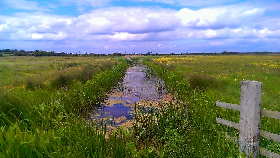
From Pevensey & Westham station, turn right and then right again at the mini roundabout. Turn left onto Peelings Lane, past a little pond on your left. After a short while you will come to the entrance to Castle Farm on your right. At first it doesn’t seem marked, but there is a small footpath sign on a telegraph pole to the right of the entrance. Go straight through the farmyard and over a stile into a meadow. The path is pretty obvious ahead of you and goes straight through a gap in a hedge, then turns slightly to the left – heading towards a footbridge. Cross the bridge, turn right (again the path is obvious) and a few yards later enter a hedgerow where steps take you up a short rise to the edge of Sussex’s attractive A27. Now then, I’m sure you remember the Green Cross Code, but I will say BE CAREFUL. The A27 is very busy and fast, but not a dual-carriageway at this point, so crossable with care. Down steps and through a hedge on the other side and we emerge on our first proper bit of Level. Paths immediately become slightly tricky to see on the ground, but you will see a footbridge ahead of you and slightly to the right. Head towards that – over another couple after that – and you will come to a much more substantial bridge over a rather wider stretch of water. This is Pevensey Haven.
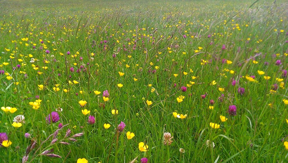
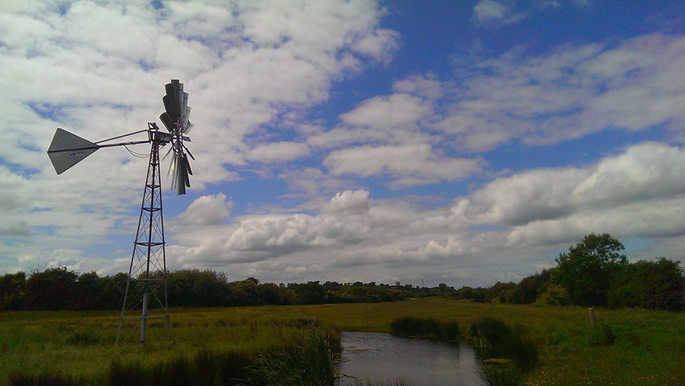
Now, I’m not good at bridges at the best of times, but this one is terrifying. IT BOUNCES UP AND DOWN. Don’t like it. I ventured on to take some pictures, but amidst the sweating, shaking and crying, they didn’t come out very well. Mainly because I was convinced I was going to drop my phone in the river. Thems of you what is also not good at bridges will be glad to know that our path doesn’t actually cross the river at this point, but turns left along the near bank to join the 1066 Country Walk. The path here is very easy to follow alongside the river. A wind pump sings eerie, metallic songs at one point – the meadow next to it deep with buttercups and red clover on the day I visited.
Keep following this path until you pass a barn and get to a cottage on a lane. Turn right and cross the bridge, there are signs at the junction of roads saying you should turn right. Do so and then left, still following the 1066 Country walk. This little place what you have just passed through is called Rickney, which I find impossible to say without doing so in the style of Patsy Palmer bellowing “RICKAAAY” at Sid Owen in Eastenders of yore.

I like the sound of this 1066 Country Walk. Perhaps it was something William the Bastard did to unwind a bit after all that brutal slaying and before getting on with his nice little hobbies, like building the Tower of London and the Harrying of the North.
You then follow the path alongside a wide dyke called Herst Haven for a good mile and a half, which gives you ample opportunities to enjoy the wide views. Ahead of you, on the horizon, you cannot fail to notice the white pimple-like dome of an observatory in the grounds of Herstmonceux Castle. This was, until 1990, the home of the Royal Greenwich Observatory and is now a science centre. The castle itself is also open to the public and stages regular medieval events. You can also see the spire of All Saints church, Herstmonceux.

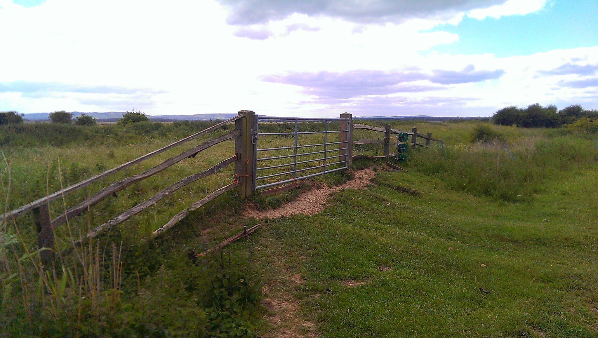
Eventually, you will reach a leaning post showing that the 1066 Country Walk turns to the right away from the dyke. Follow this round a clump of low trees and through a gate onto a green lane between hedgerows. Keep your eyes peeled for a wooden gate on your left with a bit of yellow tape on it. No other markings are apparent, but after a deal of going back and forth, peering at the map and muttering about contours, I ascertained that this was, indeed, the path I was after. From here on navigation gets much trickier. Ahead and slightly to the right you will see a set of gates. Head towards them, pass through, ignoring the marked path that leads off to the right, and follow the path leading diagonally off to the left, which will bring you back to the dyke. Turn right, through a gate and then, on the left, you will see another padlocked and unmarked gate. This is your path and you will probably have to climb over the gate. It is then easy to follow the way-marked path along the dyke to the road.
Turn left onto the lane, walk past a farm on the right and then turn right through two gates and onto a bridleway, called Marshfoot Lane. Easy going at first, this path follows the charmingly-named Whelpey Sewer before plunging into a thicket of blackthorn, which at times renders the way almost impassable. With a certain amount of swearing, it is possible to get by. This path also features a mysterious third rut in the middle of the track – covered with grass at this time of year, it is almost perfectly placed to turn your ankle. You will reach a crossing of paths, where one turns left across Horse Eye Level. From here on in I found the best way to navigate was simply to look ahead for the next footbridge, of which you will cross many. After a fairly substantial one, you will head into the left-hand corner of a field where various signs will show you have reached a bridleway. Go through the gate and turn right, over a brick bridge and immediately through another gate onto a decent track.

Follow the track, with the tower of Hailsham church obvious on the horizon, until the first footpath on the left. The path quickly goes round to the left, over a stile and then heads to the right, towards a footbridge. We’re back to navigating by looking for the next footbridge. After the first one, the path heads slightly to the left crosses another bridge, goes straight ahead and over a bigger bridge, ignoring a path to the right. Straight ahead after this bridge will bring you to a byway. Turn right and then immediately left.
We’re now at Down Level and I nearly got a bit lost here. Yes, even I, your experienced guide can get lost from time to time. That time in Churchill Square Shopping Centre being a particularly notorious example. Also, my battery had gone flat, so I was unable to take helpful pictures, which is a shame. Anyhoo, through the first gate (or maybe I climbed it, I can’t remember) the path can be discerned ahead of you, just. To the left of the end of a fairly wide dyke and then along a narrower one, do not follow the more obvious track round to the right, but keep heading straight on and you should get to a gate with an earth bridge across a ditch. Through that, past a couple of small meres on your left and each bridge was fairly obvious from the last. In the end, you will get to a field surrounded by hedgerows with the roof of a house visible. Head towards it and the path goes through a knackered metal gate onto a road.

Turn left onto the road and then right just before the next house. I must confess I completely lost the path here, after crossing the nice footbridge, the appearance of which filled my heart with hope that the way ahead would now be easier to find, only to have my hopes and dreams cruelly dashed by the lack of any further way marks. I went through an obvious chalky gap in the hedge to the left after going through a bit of scrubby stuff and being barked at by a dog. I then went straight ahead to a gate that let me onto the road. I am not at all convinced that this is the correct route of the path and neither did I see any further evidence of it from the road. Nevertheless, turn right onto the road, head straight ahead at the junction, ignore the first path on the right and take the second one through a gate and onto a track at Windyridge. This public footpath is marked if you care to search hard enough under the ivy that cloaks the gatepost.

Follow the track, which leads to a dead end, slightly alarmingly surrounded by high, locked gates, but never fear. To the left of the gate in front of you is a stile that can just about be reached through nettles. Over that and follow the hedge to your left down into a corner of the field, over a stile surrounded by beautiful trees, turn right and through another gate or over a stile or something, it’s way marked. The path goes through a narrowing gap into a horse field with farm buildings ahead. The path goes all doowacky here as well. It turns right, past a huge mound of chalk and reaches a track. I turned left here and walked through the farmyard, which almost certainly isn’t the right way, but nobody stopped me. I then came to the entrance to a rather fine house called Priesthawes and the marked footpath leads to the left, through the gates and past the front of the house. Follow the drive round to the right and down to a road.

Cross the road and follow the track on the other side, which turns right past the end of a belt of trees. The path then turns left immediately, along the edge of the belt of trees. It’s not way-marked and I had to climb over some kind of peculiar pipe thing, but this is definitely the way. You will come to a large pond on your right, which you leave to your right, following the path on the edge of the field and over a stile. The path then leads along the hedge to your right, with glimpses of the pond through it. When the hedge turns to the right, you turn to your left where the path crosses a stile and is then fenced off along the left-hand side of the field. This brings you to a track and turning left takes you over a bridge across the A27. Straight on at the other side, following an old lane with a new housing estate on your left, through a gate at the end, follow the road straight on to the main road. Turn right. Just past the Old Polegate Station restaurant, turn left through a gap in the wall and follow the road, turning right onto a path between high fences. At the end of this path you will see a particularly attractive car park, Polegate Station and, even more excitingly, a Co-op, from which I immediately purchased a pork pie.
