Life, they tell me, often goes in circles and so it is with this blog. When I first started writing about walking in Sussex I was inspired by the fact that I did not, at the time, have a car. The lack of a car by no means makes it impossible to enjoy the countryside, but it does make it more of a challenge. Especially if, like I do, you enjoy exploring new places. It is all too easy, when reliant on buses and trains, to find yourself walking the same, tired routes over and over and while there’s a lot be said for walking the same routes, especially at different times of the year – it can get a bit wearing nevertheless. So this blog started as a way to document the places I had found that could be reached by public transport, how I got there, where I walked and how I got back again.
Well, once more, I find myself without motorised wheels and, once more, some creativity and effort is required in finding new places to investigate. In many ways the experience becomes quite different when a little planning is needed. My tendency when exploring with a car was to drive around until I found myself somewhere particularly beautiful or unfamiliar, park up, fire up the OS app and see where I could walk. There are many benefits to doing this, but also many drawbacks. Almost every time I went out I’d find myself spending at least £20 on petrol and very often, even with the benefit of a motor, I’d find myself driving in the same places as I’d driven many times before, or I’d somehow never quite find a good place to stop. Sometimes I’d get home again without having walked at all.
On the other hand, of course, the great benefit of a car is that you can get to all sorts of places that public transport either renders entirely inaccessible, or practically not worth the bother. The challenge for the un-motorised walker is to find those places that are within relatively easy reach and yet still provide new and interesting places to enjoy. And while the whole thing may not feel quite as spontaneous as when you could just jump in the car and go (although, as I have discovered, it is entirely possible to run and catch a train on a whim at pretty short notice), there is a certain satisfaction to be gained from planning a trip and achieving one’s goals.
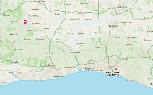
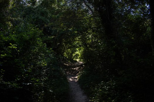
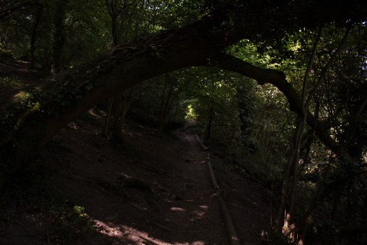
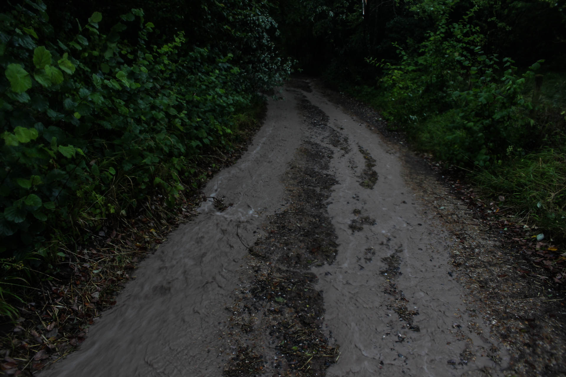
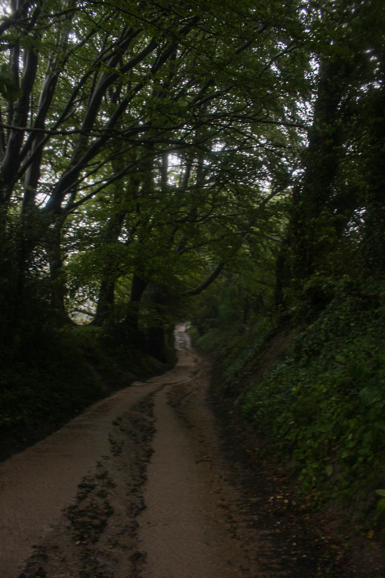
And it was very much in this fashion that I found myself at Pulborough station having decided to see if I could get up into the woods near Bedham by rail and foot. Turns out, not only can you walk to Bedham from Pulborough, but it is one of the most thoroughly beautiful walks in Sussex. This is not a walk full of grand views and wide vistas, although you do get a bit of that towards the end, but rather these paths find their way mostly through woods, or are lined by tall trees and hedgerows. In the golden light of autumn, as the leaves are turning, there can’t be anywhere much lovelier to stroll.
Pulborough itself sits on the hills just to the east of the River Arun, where it makes two great sweeps around the western and southern edges of the town, joined by the waters of the western River Rother at its first bend. From here the river runs south and is soon to punch its way through the Downs between Amberley and Arundel. The train line runs up this valley and through the gap in the chalk, but Pulborough does not sit on hills made of chalk, but ones made of sandstone. This is the Greensand Ridge, so named because, apparently, the stone, when first exposed to the air, has a greenish tint. The sandstones here are older than the chalk, but not as old as those that make up the High Weald. Because this is sandstone, the soils are light and acidic. Plenty of bracken and birch, pine plantations and and large areas of sweet chestnut coppice. Although the traditional woodland management technique of coppicing died out in most woodlands between the wars, sweet chestnut remains one of the few trees still economically worth managing in the old way. Chestnut wood is naturally rot resistant, which makes it much in demand for fencing, among other things and, of course, at this time of year, the trees are thick with chestnuts, ripe for the gathering and roasting.
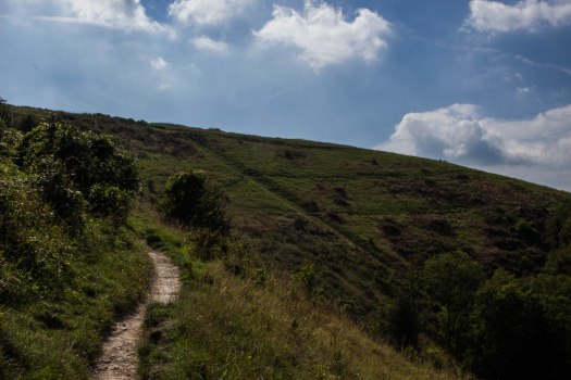
On the way to the woods the route passes Pallingham Quay – a reminder that, once, the River Arun was a busy commercial waterway before the railways took that whole way of life away. The tiny settlement of Bedham occupies the centre of the walk, nestled in the trees with its little ruined school and church that once occupied the same, purpose-built building. Climbing over the ridge from Bedham, the views open out as the path gently descends back into the Arun/Rother valley, via the tiny village of Stopham with its 11th Century church, which is worth a quick visit. I always like to pop into the little churches I pass if I can. There is no greater link back to the medieval than these humble little buildings that have stood and been loved and looked after by local people for centuries. Similarly, the path then crosses the river by way of Stopham Bridge, another monument to the skill of the medieval stonemason, this time dating from the 15th Century. The central arch was raised in 1822 to allow the passage of bigger boats.
From there the path runs back to Pulborough along the edge of the Greensand Hills and the view across the Arun valley to the South Downs beyond is both very beautiful and the archetypal Sussex vista.
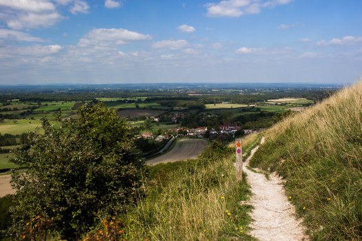
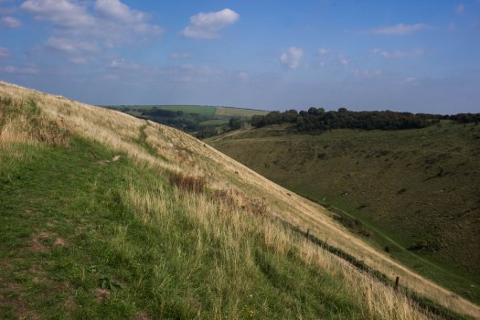
A few years ago, now, I was lucky enough to enrol to study Countryside Management at Plumpton College in the Sussex Downs. As part of the course I was required to find a suitable work placement for the first year and by a stroke of wonderful fortune I was able to get in first at probably the best such placement in Sussex: the National Trust’s Saddlescombe Farm. I have threatened to write about the farm itself on several occasions, because it’s wonderful. That day will come – but today is not that day. Today is, however, a day for writing about somewhere I’ve been intending to include in my blog for years. I suppose there are a few reasons why I’ve taken this long to get round to Devil’s Dyke on the South Downs near Brighton. Not least the fact that it is one of the best-known countryside sites in the South East and, therefore, it has been extensively written about by many authorities greater than I. Despite all that, it remains one of my favourite places and I am honoured to have spent a couple of years doing my small bit to look after it. Over those two years I came to know the Devil’s Dyke Estate – which stretches far beyond the immediate are around the Dyke itself – pretty intimately. Each discrete area deserves its own entry, but for now, here’s my two penn’orth on the mighty ditch itself.
Newtimber Hill from Devil’s Dyke
One thing that one quickly learns about the Dyke is: never walk up the middle of it. It starts out beautifully gently, but once it’s lulled you into a false sense of security, the gradient increases rapidly, becoming an unforgiving slog to get to the top. Better by far are the paths that lead up the south side of the Dyke, or over the Downs on either side. One of my favourite ways to approach the Dyke has been to park in the lay-by on Saddlescombe Road at the top of the short hill that leads up from the farm gates. You start, therefore, on the lower slopes of Newtimber Hill, itself a wonderful place, with some of the best-preserved and most species-rich downland in England. The way down is steep and crosses a stile into what appears to be a hedge, but there is a path. “I helped put that stile in” I think to myself every time I climb over it. The path after the stile is ridiculously steep and I don’t recommend it after wet weather, because it becomes terrifyingly slippery and there’s not a lot to hang onto to stop yourself tumbling down it, or reaching the bottom by sliding down on your bum in an elegant fashion. On a dry day, though, it can be descended with care. The path at the bottom, if followed to the left, leads through the trees to the bottom of the Dyke itself.
Path to the bottom of the DykeHaws at the bottom of the Dyke valley
Here, if you notice, the walls of the Dyke fall steeply on either side to reach the flat bottom of the valley and while the walls are covered with thin, poor soils, the earth that fills the bottom of the “V” is deep and rich. Over millennia, the soils of the steep slopes have been washed down into the bottom of the valley, where they have collected in deep, easily-worked deposits. Following the last ice age, it is in places like this that the first Celtic peoples to repopulate Britain made their settlements and grew their crops. The soil was easy to plough with their primitive tools in comparison to the heavy clays of the wooded Weald below them. Very little is known of these people who clung to an existence here. Their settlements were never very big and left little impression behind them. The Downs, being made of porous chalk, do not naturally collect rainwater. Any rain that falls on them seeps quickly away into the chalk, re-emerging as a line of springs all the way along the base of the north scarp of the Downs, where the chalk meets the impervious clay. There was, therefore, always this limitation on these early farmsteads. Any water for the crops, or for people and animals to drink had either to be carried from a lower spring, or collected in the man-made dewponds that were dug and lined with Wealden clay from the earliest times to a peak in the 18th Century, when sheep-farming was at its height on the Downs. One thing these people did leave behind was their drinking vessels, made from clay and decorated with impressions made by combs, the beakers of the Beaker People have survived to show us that, in these ages before written language: art flourished on the South Downs.
If, once one has emerged from the trees into the bottom of the valley, one turns right, there is a path that leads over a stile and steeply up into the woods on Dyke Hill, which separates the Dyke from the Weald. None of the woodland here is very old, being mostly scrub that has regrown since intensive sheep-grazing stopped on the Downs between the Wars, but it is still beautiful as the path winds among the trees and crosses a bostal that leads up from Poynings, made over centuries by the feet of shepherds and their sheep and the rainwater that ran in the grooves they had made. Eventually this path meets another steep path that heads straight up the hill in a long series of steps, before emerging from the trees onto the open hillside, affording wonderful extensive views along Fulking Escarpment towards: Truleigh Hill, with its radio masts, Chanctonbury Ring with its crown of trees and, even further, to Bignor Hill and Glatting Beacon away in the far distance; another superb place to walk.
Steps lead into the woods on Dyke HillThe path through the woodsFulking Escarpment, Truleigh Hill and Chanctonbury RingNewtimber Hill
The trees that the path emerges from here are mostly coppiced hazel, planted by the shepherds of old. Hazel, when cut close to the ground will respond by sending up new, vigorous shoots that grow into straight, pliable rods, which are useful for all sorts of things. The wattle latticework to which daub was applied makes up the structure of many an old house’s walls and it was also superb for weaving baskets. The shepherds would have used much of it for making hurdles – small gate-like panels for controlling the sheep when they needed to be held in a small area for a time, such as before shearing. These days hurdles are made of light aluminium in factories, but in days gone by, coppicing and hurdle-making were essential skills for a shepherd to possess.
While sheep farming remained the defining activity of the Downs throughout the 19th Century, another, new breed of people began to arrive on the hills: tourists. Nowhere received these new visitors with more enthusiasm than Devil’s Dyke and as our path leads up to the top of the scarp, we can see evidence of those early thrill-seekers. A wide, shallow trench runs from the top to the bottom of the hill, the path crossing it near the top. In the Victorian era there was a funicular railway here that carried passengers down to the Royal Oak Hotel and Tea Gardens in Poynings. The grand Victorian pub is still operating, the humbler little cottage directly behind it being replaced as the original inn when the new hordes of tourists proved too many for its small, low rooms.
The funicularLooking down the funicular track bedPoynings and the Weald from near the funicular track bed
At the top of the hill there stands another, modern pub. Few are those who commend it for its architecture, but on a cold and windy day it can still be a welcome sight, if not as attractive a one as the Georgian building that preceded it. Turn away from the pub, though, and look back the way you came and you will see what Constable described as the “grandest view in the world”… I mean, it’s a pretty grand view all right. You can see for sixty miles to the Hogsback hill in Oxfordshire, right across the Weald to the North Downs and the Greensand Ridge in the north west and to Ashdown Forest and the High Weald to the north east. To the south west, like a dark smudge against the silvery horizon lies the Isle of Wight and there are extensive views along the Downs as described before to the west and along to Newtimber and Wolstonbury Hills to the east. The grandest in the world, though? Perhaps Constable needed to get out a bit more – at least of this country.
As you reach the top of the hill you could easily miss that you have crossed into one of the largest prehistoric enclosures in Britain. All around the top of the hill is a roughly rectangular chalk rampart and ditch. Incredible to think that these walls were built by people using only the antlers of deer as pickaxes: antlers being the hardest tools known at the time. The enclosure can’t have been for a settlement due to the lack of water and it’s too large for a hill fort, like the one at Chanctonbury. It is believed that it was probably used as a corral for livestock.
The ramparts are the green lines in the long grass to the right of the path
Besides the pub, there are other scars on this hill that bear testament to the bustling place this was at its touristic 19th Century height, when trains from Brighton brought passengers in their thousands to see the Dyke and to enjoy the fairground that once stood here. A shallow, oval depression in the ground is all that remains of the bicycle railway, that allowed guests to pedal round in circles on bicycles that hung from a wooden rail above their heads and the crumbling remains of two concrete platforms mark the alighting points for the cable car that once powered back and forth high above the valley itself.
What remains of the landing stage for the cable car
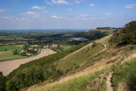
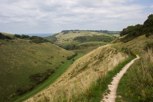
And this truly is the moment to appreciate the grandeur of Devil’s Dyke. Take the path that runs across the top of the “V”-shaped valley and look down the length of it to the hills at its end – Saddlescombe Farm nestling peacefully among them. Many suppose that this valley was carved out by some kind of glacial action, but in fact it owes its existence not so much to the glaciers themselves, but to their demise. During the last ice age, the glaciers came no further south than north London (East Finchley Tube Station, in fact). The Downs, at that time, were one enormous dome of chalk, pushed up by the same action that created the Himalayas and the Alps: the moment that the Indian subcontinent crashed into the rest of Eurasia. The chalk being highly porous, most of it was washed away when the glaciers melted, some ten thousand years ago, leaving just the very edges of the dome, now known as the North and South Downs. The Dyke, likewise, was made by a river of meltwater, mostly from the frozen tundra that made up the soils of the Downs in those days. The same action of water washing down continues to erode the dry valleys, of which Devil’s Dyke is the biggest, and the bostals deeper into the chalk.
Devil’s DykeDevil’s Dyke and Newtimber Hill
Many are the legends told of this great ditch, as people of times past tried to understand its creation. The Dyke gets its name from a legend that relates how the Devil was digging through the Downs in order to flood the Weald with seawater, but an old woman, seeing what he was up to, lit a candle to fool her cockerel into believing that the sun was rising, which crowed lustily and scared the Devil away from the approaching dawn.
From the top of the Dyke, a path runs down the length of the slope on the southern side branching to the left from the South Downs Way. Take the right hand fork where the path splits as the valley turns to the left and cross a stile into a field. Follow the path straight ahead to where a stile takes you to the edge of Saddlescombe Road, opposite the farm gates. Turn left and walk along the verge to find a path that will lead back to the lower slopes of Newtimber Hill, just below the lay-by where we parked.
This walk can also be started at the Devil’s Dyke pub, where there is a large car park and regular buses from Brighton Pier.
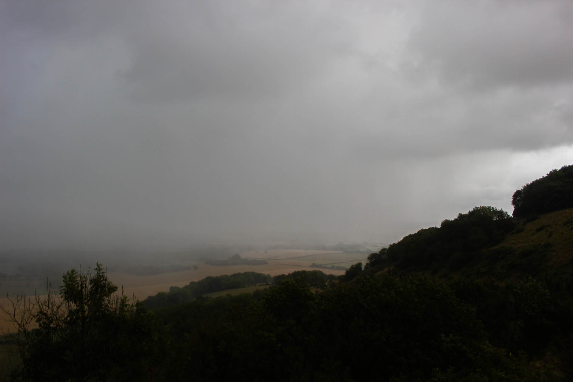
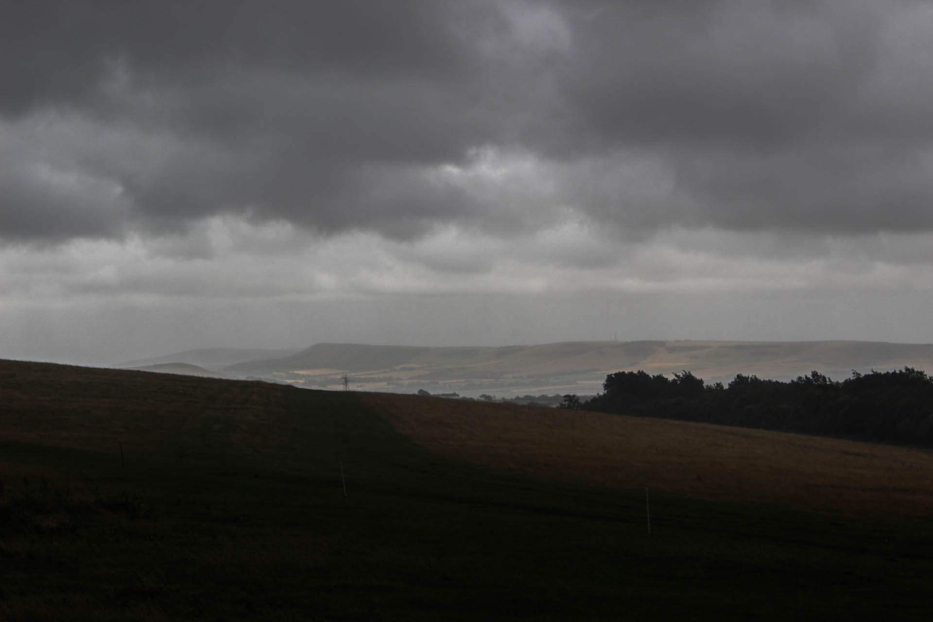
There was something about it that had been niggling at me for days. Ever since the heatwave had broken there was, in me, a need to somehow experience the realness of the world. Those weeks of heat and dust and uniform light had seemed like another world and then, when the storms finally came, they had washed the parched earth clean and made it new again. But for one reason and another I hadn’t been able to be out in it and it seemed necessary, somehow, that I should feel the wind and the rain against my face. That this glorious reminder of our living world should refresh and reawaken me from my months-long torpor. The heat had stupefied me, dulled my senses and made me unwilling to get out and walk and if there’s one thing that defines me it is that I am a walker. I feel and experience the landscape by being in it. By facing the winds that blow over the hilltops, by slipping into the cool darkness of the underwoods and by following the ancient paths kept open by nothing but aeons of labouring feet that have walked before me.
Walking in adverse weather, of course, is an experience that brings those past days back in a deeper way than any other. In those times the countryside was a place of toilers who had little choice but to be outside in all weathers, and no hot bath to get home to. Or of travellers whose weary destinations lay not at the end of a drive in a heated car with music playing on the stereo, but only after many miles had been traversed, one step at a time. These long scars in the fields where the grass grows short, or not at all, that still lead the way are the result of all those feet. Those dragged boots of all those workers and walkers. To walk now for leisure can give us only the merest glimpse of what those fields and paths must have meant to those who travelled upon them in centuries past; but their paths are still here and my boots do follow where they once trod – and the ageless weather throws itself upon us now just as it did then.
However foolish it may seem, there is a connection with those workers and journeyers as one stands on the knife-sharp edge of a bostall as the rain sweeps in over the Weald. These sunken tracks are ancient, worn by centuries of feet, both human and ovine and deepened by the rain and the frost. Their existence stands testament to an earlier age of sheep and corn, those endless days where the sheep were walked up onto the wide open Downland pastures as the sun rose and led back down into the fields of corn at night, their manure, more plentiful in the hours of darkness, to fertilise the crops. And here, now, I stand too, looking out over the ancient network of fields and hedges, of woodlands and lanes. I look out and I see the old spires of the churches rising up from the thickly wooded landscape. Those old, crumbling buildings that have been tended and loved by countless carers over countless years. I stand and wonder how many have stood in this spot as I stand now and looked out over those fields and woods and steeples and villages. The rain lashes my face so I have to close one eye as it once lashed the faces of an innumerable line of human shapes that stretch into the grey, misty distance behind me. I do not work as they did. I can go home to a warm, dry home that many of them would not have had. But I can stand in their footsteps and remember them.
With all this in my heart, I went to a place that always calls to me in times of rough weather. I went to College Bostall, above Plumpton College, where I studied Countryside Management some years ago. The bostall crosses the larger Plumpton Bostall, deep in its trench and covered with concrete since the Second World War, and strikes out across the open side of the Downs, with the college itself at the feet of the hills. Near the top there stands a solitary sycamore, rushing and roaring today in the wind and the rain. As I stood on the top, the rain came down so hard I wondered if it were, in fact, hailstones. My boots filled up from the top down, so that every step sent small squirts of water back out over the brims. I knew, of course, that the car was nearby at the bottom of the hill and that I was quite safe, no matter how wet I got. I wondered what those old shepherds would have thought of me, standing like a fool and wondering at the curtains of rain that had come and veiled the view of far-away Firle Beacon that had been bathed in sunlight just a few moments before, like a bright island floating above a sea of grey.
In the end, though, of course, I returned to my car and my warm flat and those ghosts are just memories, or ghosts of memories – washed away in the rain.
Since developing an interest in photography a curious thing is happening to me. I find myself looking forward to winter. For all my life I have longed for spring during the cold, dark, rainy winter months and that season still provokes an excitement in me like no other. Indeed this new anticipation for winter is not a rejection of the other seasons, which all have their own glories, but a wonderful new reason to live and experience each season on its own merits and, in the particular case of winter, to appreciate the light.
The hills where the River Uck rises, High Weald
Summer remains, of course, a wonderful time of long evenings and pub gardens and oh how I longed to not be knee deep in mud and water-logged meadows as I slogged about the countryside just a few months ago! It’s true that the actual act of walking is easier at the moment. No slipping down steep banks, or unexpectedly finding oneself with a wet foot after disappearing into a puddle you couldn’t even see under the fallen leaves. I remember well doggedly following the official footpath (rather than circumnavigating) across a sodden ploughed field in the Rother Valley, the mud clinging to my boots and dragging more and more heavily with every step. I almost wondered if I would make it to the other side. In the end I staggered back to the car exhausted… but elated.
Mud in the Rother Valley
The countryside is a different place in the winter. The great crowds of the summer are gone, even on the South Downs Way – the footpath equivalent of a motorway – and one can wander the paths and tracks almost alone. Whole days I have spent not seeing another soul. Even the farmers can’t do much and absent themselves from their rain-lashed fields. Fair weather walkers may think me mad to deliberately go out, staggering and slipping as I go, but there are rewards and the greatest of them is the light.
Rye Harbour
Summer light is flat and bleaching. Detail gets lost. Subtlety disperses in a landscape of high contrast. Of light areas and dark, with sharply defined edges. There’s no challenge to taking an ostensibly “beautiful” photograph when the sun is shining and the great cumulus puffs float against a deep blue sky – and there’s very little interest in it either. Anyone can go out in the summer, see a beautiful view and point a camera at it. Not everyone is prepared to trudge through several miles of mud on the off-chance that the sun might peek through the clouds for long enough to make a scene worth photographing. But for those who are prepared; those moments are among the best. To round a corner and suddenly find a shaft of sunlight is lighting up a stubbled field, the oak tree skeletons silhouetted against the sky. To stand on the shoulders of a deep valley and watch as the sun finds its way through heavy clouds, throwing dramatic crepuscular rays across the landscape. To emerge from a wood into a deep, still silence, frost carpeting the ground, while a stag grazes quietly. These are the moments that have, for the first time, made winter worth enjoying.
High Weald near Penhurst
Rays over Seaford
Now, of course, all of these things were happening before I got my camera, but its acquisition was the push that I needed to get me out there and experiencing it all. And a big part of the thrill is seeing things that many others do not. There is a great glory in being that lone figure – my coat wrapped around me and the collar turned up against the cold – standing and watching the rain sweep across the hills, the light chasing and being chased about the valleys by the clouds and those dark smears of precipitation. Only a summer storm beats those moments of exhilaration and yes, of course, this is England. I may be sitting in the middle of a heatwave this year, but rain in summer is not an uncommon thing: but even then, the light is not the same. With the sun high in the sky, the same effects are not felt as when it barely peers over the horizon – even at midday – and its light seems to spread over – almost through – the landscape, rather than shine interrogatively down at it. I haven’t even touched on the fact that it is easier and more satisfying to wrap oneself up and stride determinedly ahead in an effort to warm oneself up than it is to sweat beneath a glaring sun.
Shemanbury, Low Weald
Ringmer, Low Weald
Towards Brighton from Blackcap
Fog over the South Downs
Mist at Wilmington
Witherenden
So here I sit on a, supposedly, beautiful day, writing words about winter with the blinds drawn… and I have to admit that I am beginning to realise that, perhaps, I am not a fair weather walker. Perhaps… perhaps I am becoming a foul weather walker?
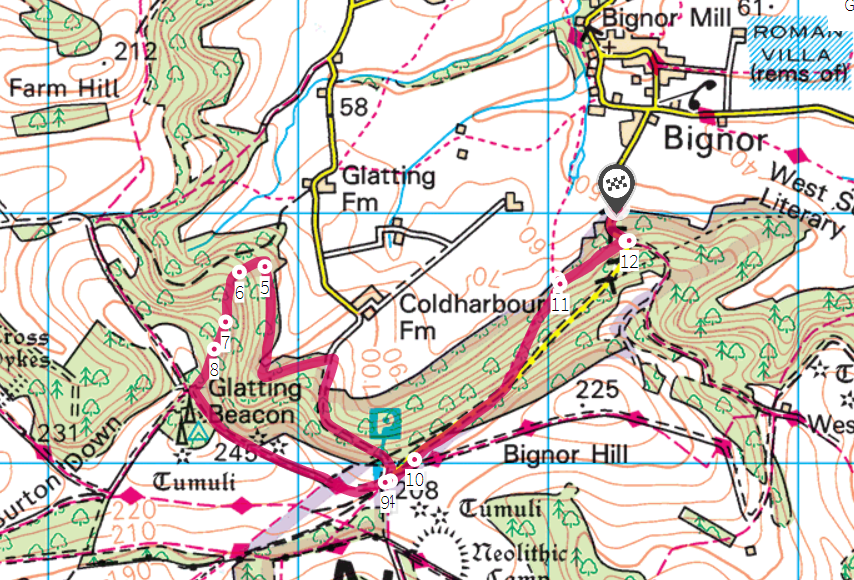
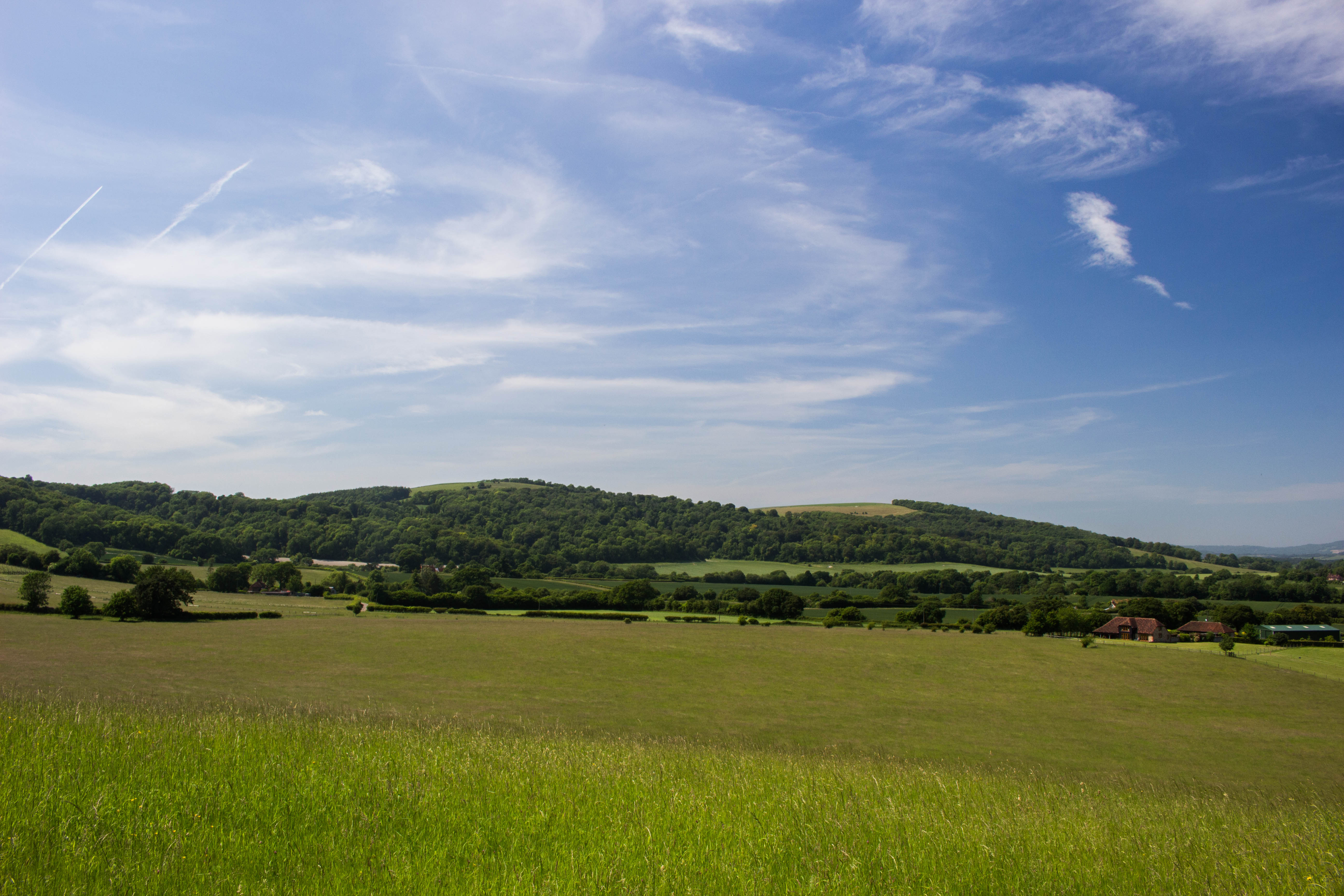
If there’s one place on all of the beautiful South Downs that I keep returning to, it’s the area around Bignor Hill in West Sussex. The jury’s still out on whether it’s the “best part of Sussex” (There’s at least six or seven “best parts of Sussex”. Maybe I’ll do a list), but it’s certainly one of the most gloriously rural parts of the long stretch of the Downs, allowing one to walk for miles without being disturbed by the sound of a car. A lot of the East Sussex Downs are, of course, very beautiful, but almost always there is a fairly major road at the bottom of the hill, or not too far away so there’s always that reminder going on in the background that the real world (Hmm. Maybe that world is unreal and the world of hills and woods is the real one?) is hurrying on and making sure you know about it. Newtimber Hill is achingly beautiful, but the constant roar of the A23 puts a definite dampener on it.
None of this is a problem at Bignor and, aside from the occasional car that makes it up to the National Trust car park at the top (following the old Roman Stane Street for part of the way), you are left to the natural sounds of Sussex: the birds, the wind in the trees, the people shouting at dogs… I mean, you can’t have everything. This is Sussex after all. It’s never going to be wilderness.
Barlavington Down
I’ve usually, in the past, done much the same walk every time I’ve been up the Hill; which is to loop around via Glatting Beacon and Barlavington Down and back across the Weald to the car, which I’ve tended to leave in Bignor village itself, or (as I did today) at the bottom of the hill on the road up to the car park. Today, though, I thought I’d explore around a bit more, so I parked at the bottom of the hill where there’s space to leave the car while still leaving enough room for others to use the passing space and, at first, took my familiar route to the top. As you walk up the road you enter a wonderfully deep bostall and just after that section, before the road bends sharply to the right, there is a track leading off to the right. It’s not an official path, but this is all access land and part of the National Trust’s Slindon Estate, so we have the right to roam on it. This beautiful track leads through the trees to an actual public footpath (where there is a wonderful view over the fields, peeping out from under the eaves of the wood). Turning left the footpath leads fairly steeply up the hill, rejoining the road a hundred yards or so from the top. You could walk up the road itself if you wanted, but this way is nicer.
Bignor through the trees from the bottom of the road to the car park
The road up to the car park
The road in its deep bostall
The track
Barlavington Down from where the track meets the footpath
The footpath
Having gained the car park, there’s then almost immediately a track off to the right going back down again, which I followed back down to and then along the edge of the woods. At the far end of the access land there is, according to the map, a track that goes back up to Glatting Beacon. Let me tell you something. This track does not exist. Neither is it possible to tell where the access land ends and private woodland begins. Nevertheless I headed up the hill, following what may have been an overgrown trackway, or bostall, or cross dyke or something. Despite the steep gradient I made fairly easy progress, there not being too much undergrowth and found the main track again at Glatting Beacon. This I followed back to the car park and then back the way I’d come to the car.
Beautiful beech trees
A single beautiful beech tree
One thing that sets the more westerly Downs apart, aside from their generally more rural nature, is that they are much more wooded than their eastern counterparts. While much of the Downs was cleared of trees thousands of years ago to make way for the grazing of sheep, large areas were planted with useful trees to grow – as a supply for the local shepherds and farmers and as a cash crop. There are large areas of hazel and a great deal of ash (suffering, sadly, quite badly here from the dieback fungus), but in particular mighty, beautiful beech trees were grown, coppiced roughly every 250 years, in woodlands on the steeper slopes known as “hangers”. The woodland I was mostly in today is known as Lamb Hanger, thus neatly encapsulating the two primary purposes of the Downs in one name. Beech woodland has to be one of the most beautiful forms of woodland on earth. The tall, elegant, smooth-grey trunks of these enormous, yet most graceful trees. The fresh, bright green of the canopy in spring and summer, replaced by the most wonderful coppery gold in the autumn and winter, the old leaves eventually falling to carpet the ground with gentle gold as the next season’s growth unfolds above them.
Ash affected by the dieback chalara fungus
Golden carpets of last year’s leaves
Pretty sure all these trees are actually all the same tree
Beech may have a habit of falling over, but that doesn’t mean it’s just going to give up on life
Traditional management of beech hangers has, in many cases, ceased and these wonderful trees are left to die. This isn’t necessarily a bad thing. Beech naturally starts to fall apart as it gets older (it gets every disease under the sun too) and eventually the trees come to the end of their lives leaving a large amount of both lying and standing dead wood. Both are wonderful for different insects, known as decomposers, which will slowly consume the old, rotting timber. Standing dead wood also provides potential places for woodpeckers to make their nests. Beech also reseeds itself quite freely, so there seems little danger of it becoming a thing of the past on the Downs. It seems a shame, though, for all that beautiful wood to go to waste. Beech is perfect for making furniture from, but such is economics, I suppose.
The track back down from the car park through Lamb Hanger
A view across the weald from under the eaves of Lamb Hanger
The track from Glatting Beacon
The track from Glatting Beacon
Part of the road that follows the course of Stane Street
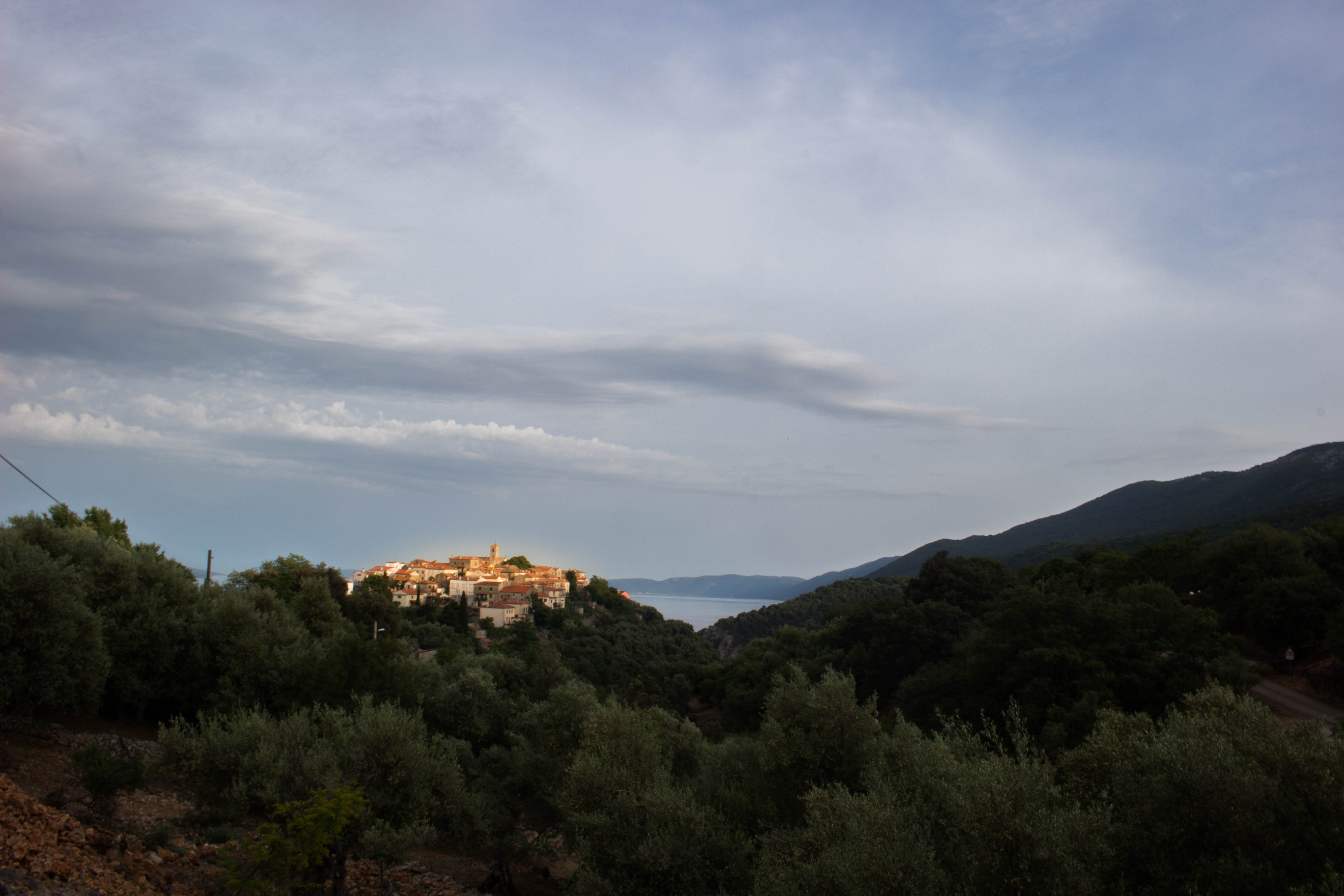
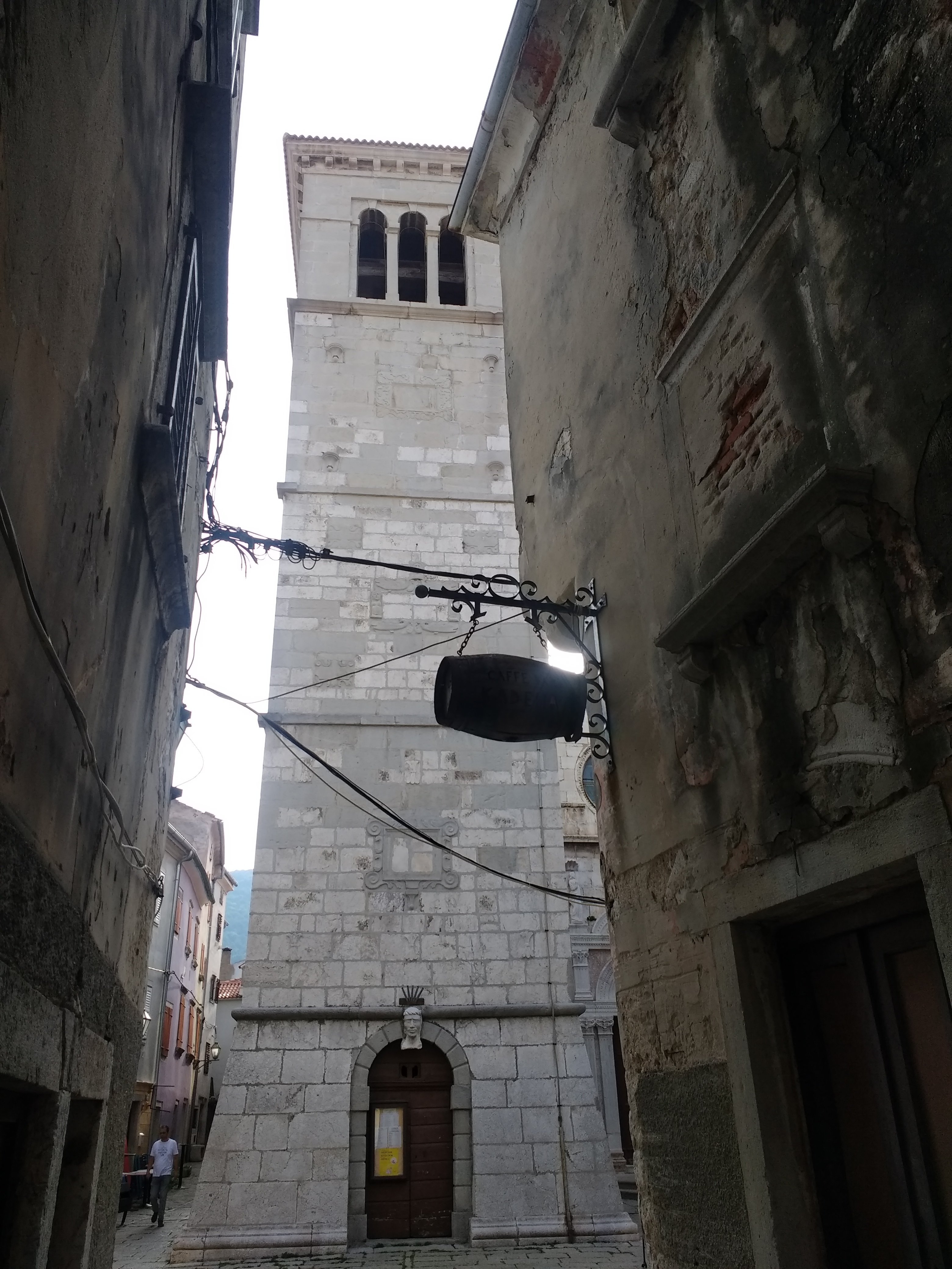
To the east of Croatia’s Istrian peninsula there lies, amid the deep blue of the Adriatic, an island called Cres (pronounced “Tres”), which my travelling companion has on good authority is “amazing”. And it is thus that we find ourselves stepping down from the Pula – Zagreb coach onto the roadside in tiny Zagore, the sun beating down as we shoulder our packs, slather ourselves in cheap Lidl suncream and start the walk to Brestova to catch the ferry. Of course there’s no public transport to the ferry terminal, so the only option is to walk and we are carrying all of our camping equipment and a fair amount of food and water on our backs. The plan is to catch the ferry to Porozina and walk over the island to Beli where there is a campsite. We’re not sure if we’ll have time to make the whole walk before dark and the suggestion of wild-camping on the way is in the air.
The afternoon sun is hot as we walk down the steeply winding road to Brestova. Occasional cars – German and Italian mostly – sweep past us as we plod on and a coral blue/green snake slithers its way up a nearly sheer cliff-face beside the road as I walk past, small shards of rock tinkling to the ground as it goes. After 45 minutes we make it to the ferry terminal in time for a cooling radler (a kind of shandy made with cloudy lemonade and other flavours like grapefruit. We should do more of this kind of thing in the UK) at the terminal buffet while we wait for the boat. When the boat arrives we troop on, the only backpackers, with a few other foot passengers and go up into the main interior seating area where a lounging steward looks at us in surprise. “Hello” he says, a little gruffly. “Hello” I respond. He looks in askance, an expansive gesture asking the question “What are you doing here?”. “We just got on” I venture. “Ay, ay, ay…” comes the response. We leave and go up to the deck to sit on the rows of seats in the sun for the twenty minute journey to Porozina. Soon the seats fill up, once the cars have come on board and disgorged their passengers and the boat makes its way across the strait to Cres.
Porozina is a small village set a little above the ferry terminal, with its little shops and cafes, that almost hides from the hordes of tourists that come over on the boat amidst the forest. The main road to Cres Town turns away to the south, but our walking route to Beli takes us up a side road, through the village and then steeply up through the woods, following a rocky track. The way is tough, especially with our packs, but the trees shade us from the worst of the sun and the way, at least to start with, is easy to follow, little red and white target-like way markers are painted on the trees and rocks to keep us on the right path. Soon we have climbed enough for spectacular views to show themselves when we come to occasional clearings in the forest and we sit for a moment to rest and admire them. Wildlife is abundant all around us, especially many beautifully iridescent beetles. We see deer among the trees and hear more than see a number of grunting, snuffling wild boar.
Eventually we make it to the top of the ridge of low mountains that make up the island and start to make our descent. Checking the time, we realise that we have a chance of making it to Beli before nightfall and now that the going is easier we make a little more haste… and promptly get lost. The waymarks that had been so easy to follow are suddenly faded and indistinct and soon we lose them entirely. The map comes out and the compass with it while heads are scratched and various tracks pondered. Eventually we find our way back to the path and, followed by a gang of oddly sinister and persistent sheep, the rocky path between drystone walls gets steeper as we descend towards Beli. I’m beginning to wonder if I’m going to make it by now as I pick my way down the rocky tracks, ever conscious of the possibility of spraining an ankle (something I am annoyingly prone to) when suddenly through a gap in the trees I see the town clustered on its hill against the backdrop of deep blue sea ahead of us, its old stone walls and terracotta roofs glowing honey and gold in the evening sun. Spurred on, we walk to the edge of town and, following a sign, take the long, steep, sweeping road that spirals round the steep hill down to the small harbour at its foot.
The reception for the campsite is closed. As we stand pondering this a German teenager sitting outside tells us that the campsite itself is closed “But.. you can camp. Just, no water. But there are toilets”. So the camping will be free, which is nice, but there’s no drinking water, which is less nice. We stumble about the campsite in the gathering gloom, failing to find a good spot to pitch our tents. After a while the German girl reappears and tells us that if we go up the hill and into the trees a little there are many places to camp and we soon find a good spot under a pair of olive trees that becomes our home for the next few nights.
There are two beach bars open at the harbour along with a diving centre, scuba diving being a popular pastime here, and we wonder at the campsite being closed, because it is packed and surely there is money to be made from all these campers. Exhausted, we repair to the bar staffed by a taciturn Herzegovinan gentleman who serves us, his only customers, some beers and goes back to watching a Swedish disaster movie on the enormous TV in the corner. The plot of the movie seems to revolve around a cliff-face that is in imminent danger of collapse into the Baltic which will produce a tsunami and flood a town. As the film reaches its climax and the waves crash into the lines of escaping Volvos, the heavens above Beli itself suddenly open with a crash of thunder and torrents of rain hurl themselves at the canvas roof of the bar. “Tsunami!” Says the barman looking up. How we laughed.
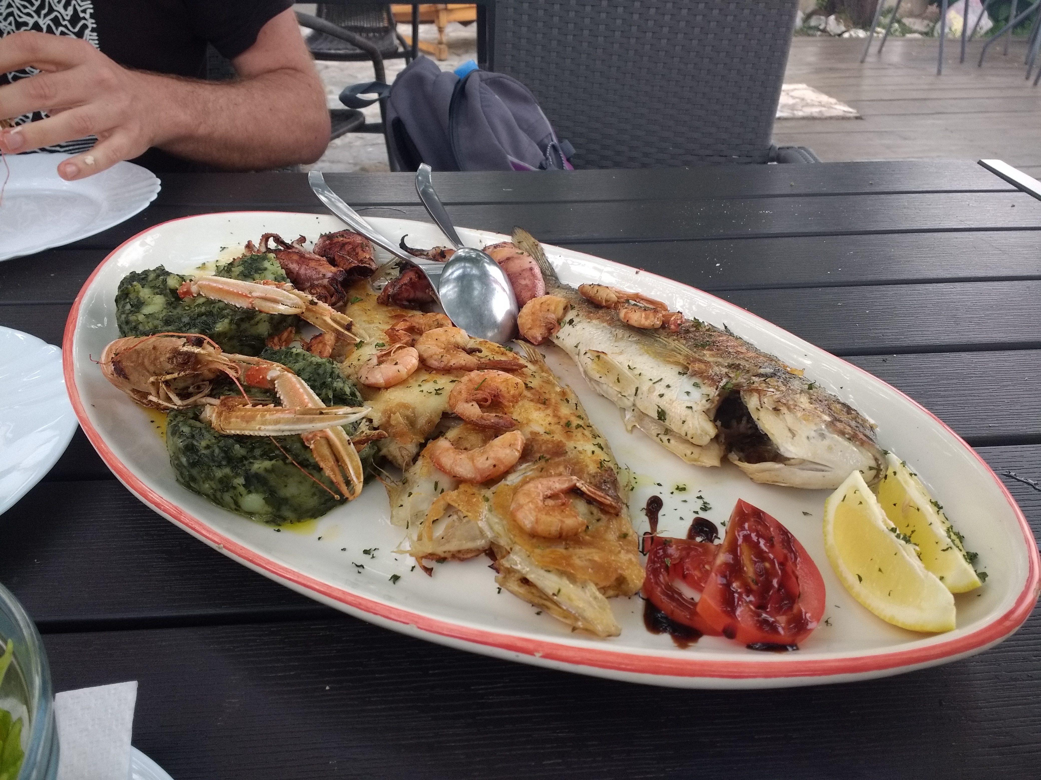
The next day the sun is out and we explore around a little. My friend goes further than me and busies himself clearing up plastic on a beach in a nearby cove while I snooze in my tent. That evening we climb the road back to the town and indulge in the most amazing fish platter for two at one of the local restaurants, followed by the traditional offering of home-made flavoured schnapps as we pay the bill and chat with our friendly host.
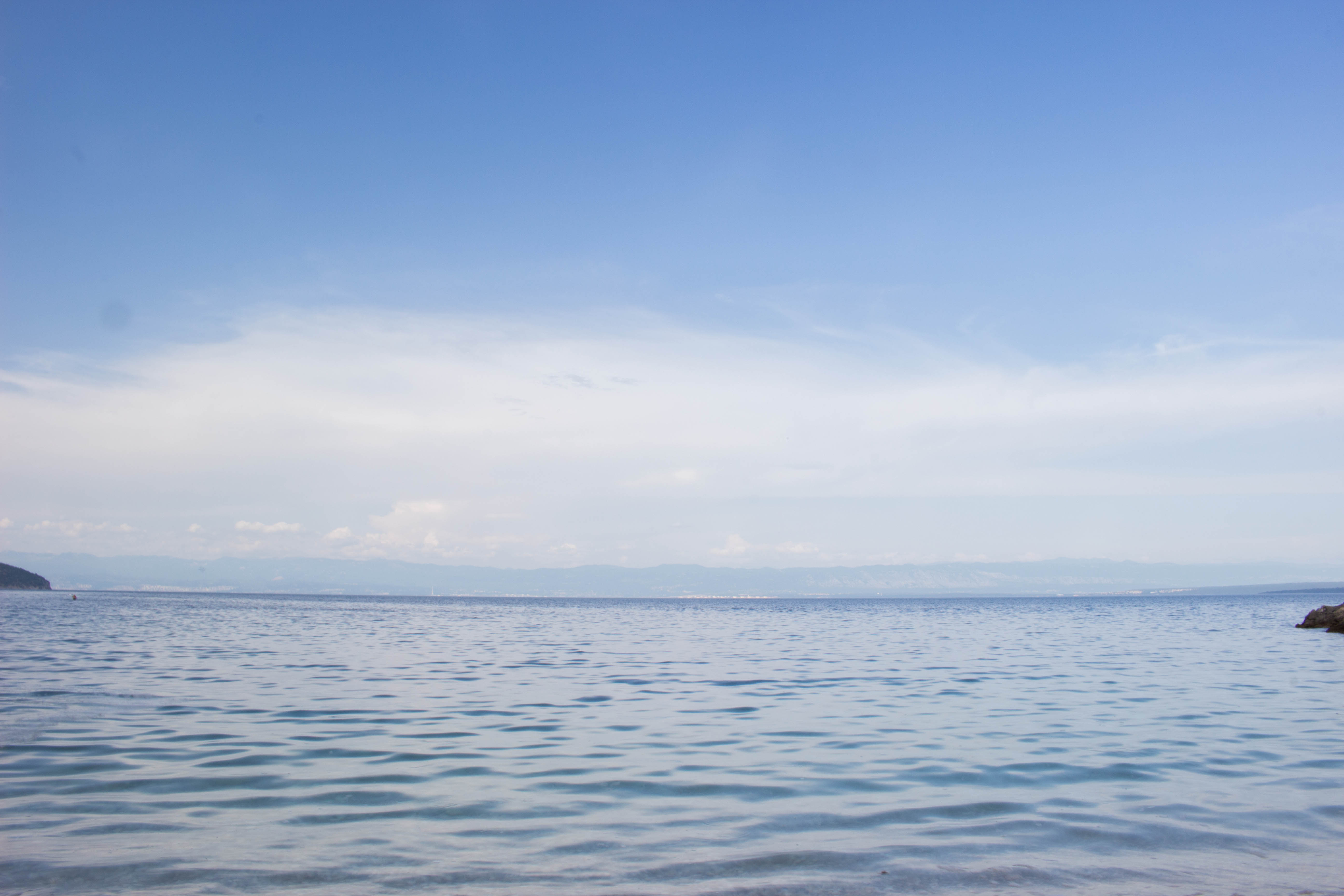
The day after we spend mostly splashing in the sea. Or I do at least. My friend is back to his eco-warrior beach clearing. The clear waters are teeming with fish and above us circle one of the things this island is famous for. There is a colony of griffon vultures just along the coast here and we see several over the course of the afternoon. Once common over much of Europe, changing sheep farming practices have seen their numbers severely reduced and they are now protected. Sadly the tourist boats throw rocks at the birds nesting on the cliffs to get them to fly, which leads to many juveniles falling into the water and drowning. Up by our restaurant there is a rescue centre occupying a former school built during the island’s period of Austro-Hungarian rule.
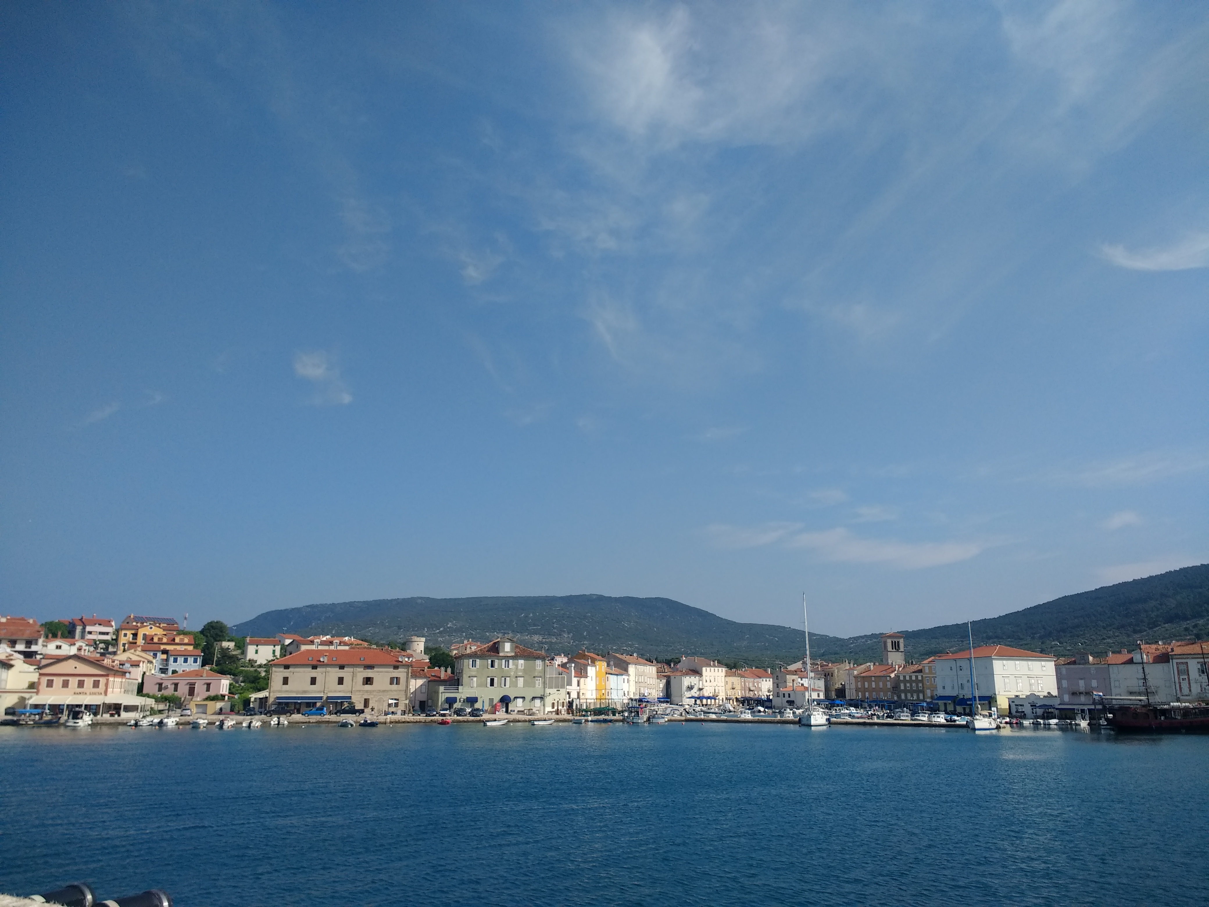
It is difficult, now, to make a living on the island and many of the houses are empty of permanent residents, holiday-makers now dwell in them in the warmer months. There are no longer children enough in Beli to keep the school open and those that are left are taken by bus to Cres Town for their education. The school bus is the only public transport on the island and it leaves Beli at 7.15am, so we find ourselves slogging back up the hill to catch it far earlier than we would have liked to rise, for we must get to the city of Rijeka on the mainland to catch the coach back to Ljubljana and our flight home. It’s good that there aren’t more tourists wanting to make the journey, because there are only two spare seats on the minibus, which makes its way along extraordinary precipitous, winding lanes to the island’s beautiful capital.
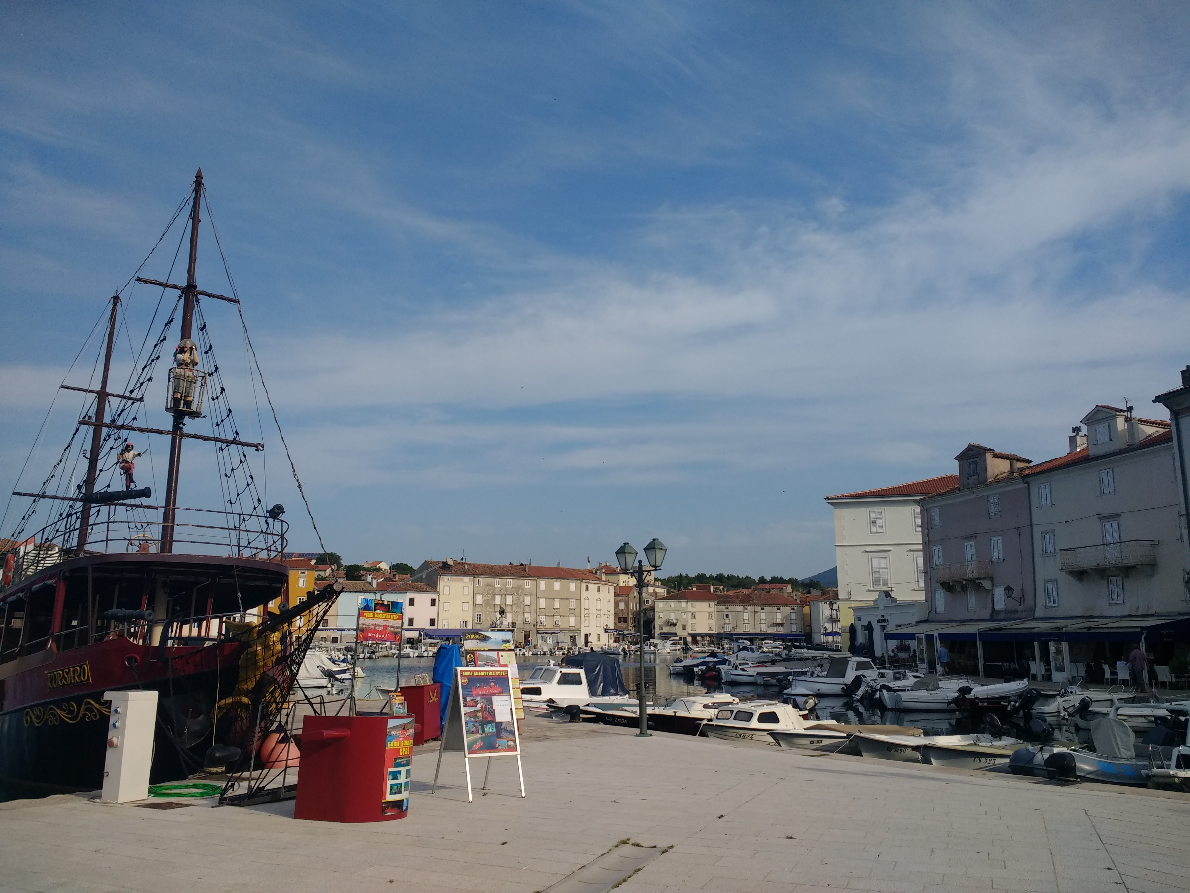
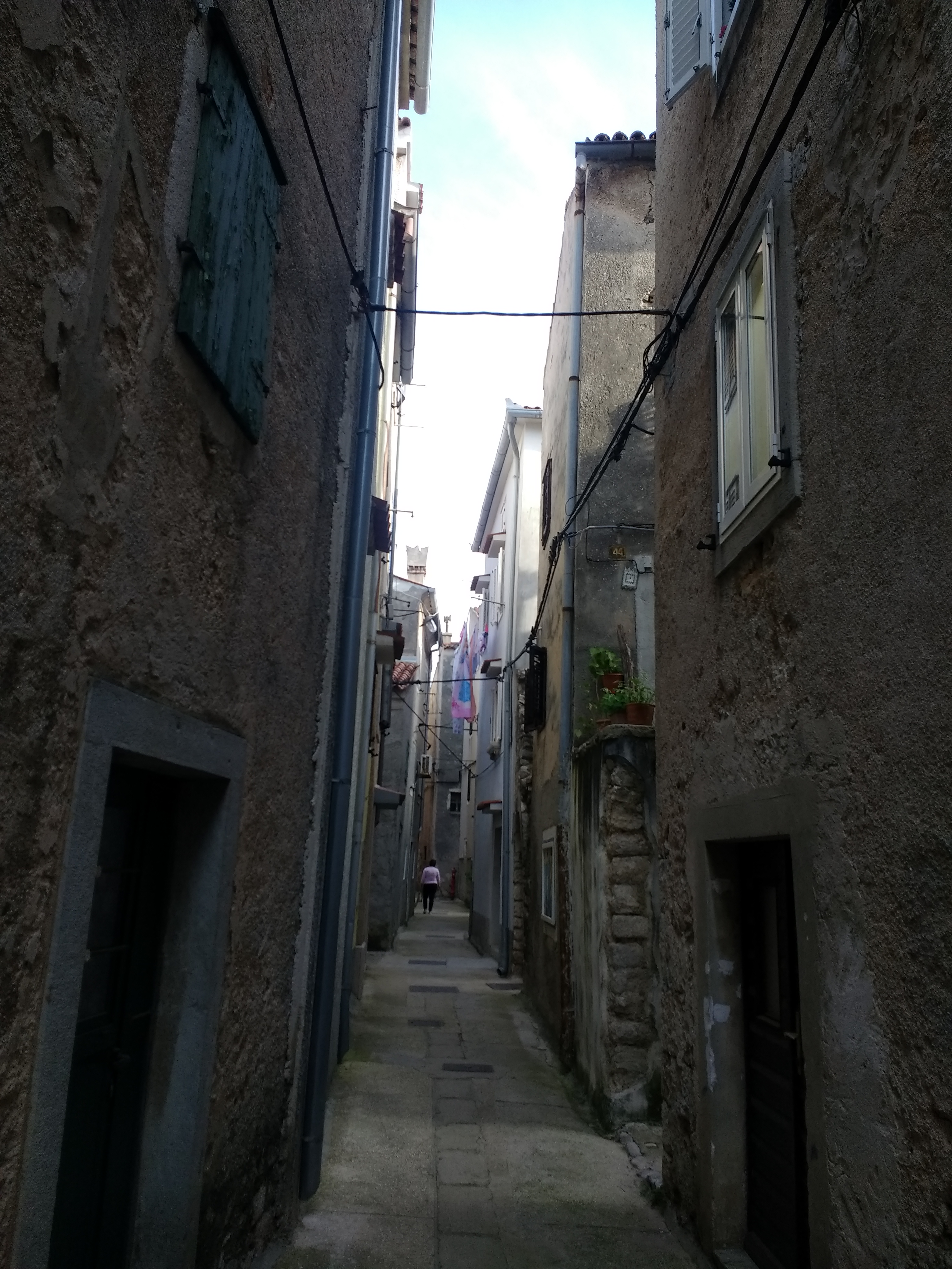
In Cres Town we have only an hour or so to explore the warren of narrow alleys between tall, crumbling houses before our passage, in the form of a catamaran, to Rijeka arrives and whisks us back to the real world of cities and buses and airports. As we leave, we both say that we will come back one day to see more and, if we’re really lucky, taste that wonderful seafood platter beneath the grapevines on the terrace overlooking beautiful Beli – which will live in my memory – once again.
I once wrote a song in which I complain that “I sit in my basement flat with never sight of a tree/and as the rain runs down my window I wonder if I’ll ere be free”, and I find myself in a similar position this rainy Easter Monday, as the traditional Bank Holiday weather makes itself felt. In the interests of full disclosure, I must point out that if I actually opened the blinds I would be able to see the two spindly, ivy-encumbered apple trees that dwell in what passes for my back garden and, indeed, the enormous eucalyptus that stands like an alien giant and surveys us all a few gardens up. The song, of course, has more than a streak of self-pity in it and in my defence I wrote it in the living room where you can’t see any trees. Or anything else much other than two wheelie bins, for that matter. What it’s about, of course, is what happens to my brain when I’ve not had access to the countryside for too long. I live in a great, fun city that I love, but if I don’t get to wander free under the sky as often as possible, I start to suffer and city streets are no compensation for country tracks and muddy fields.
There is a primality to walking that is difficult to fully put into words. Something about an act as simple as putting one foot in front of the other that can propel one over mountains. It is an act that humans were built for and that simple act connects us all the way back to the first hominids who stood up to get a better view of their surroundings, their enemies and the way ahead. In many ways, of course, we are separated by eons of history, technology and development, but in many other ways we are still those primal, wary beings, seeking to explore and understand our world. Our post-industrial separation from the land does us as individuals, and our species as a whole, much harm.
Now it is very easy for me to sit here in my centrally-heated flat with its electric lights and its internet connection and its waiting car outside that can whisk me unnaturally to places I choose to walk. There are, of course, many wonders that our industrial world brings us that I would struggle to wish to do without, but that’s not quite the point. We can all make connections with the land that lies beneath our city streets and the landscapes that surround them. Every tree and park. Every garden is a portal into the wild and even though England stands as one of the most managed landscapes in the world, it still keeps those hidden gateways to another, non-human world. A world we choose to ignore at our peril.
Throughout my adult life I have suffered from poor mental health and, particularly, anxiety. There is nothing that calms me more than knowing that I remain a natural being under the sky. That simple act that connects me to those distant ancestors is one that has always helped soothe and replenish what, for want of a better word, I will call my soul. To place my feet in their footprints and follow them is a solace for which I know no comparison, but beyond paying homage to those who went before: it is also a connection to what is real and happening now.
Not all of what can be seen around us in the countryside is cheerful. There is a biodiversity crisis in the fields of Old England. Songbird populations are plummeting. The ash trees are dying; the elm already gone. Hedgerows have disappeared and vast fields spread in sterile, serried grids to horizons shorn of the trees that used to cover them. Yet there is still enough there remaining, scattered and fragmentary though it may be, to allow one, if one pays attention, to look through those windows into the wild and to see that other world and to imagine oneself an earlier human watching the rooks high in the branches of the trees that were once believed to be Gods or entities that connected us to the heavens. We can still stand on the hillsides and look out over the valleys below us and try to discern the way ahead. There is much that is upsetting and difficult, but with that primal vision still somewhere within us, there is always hope.
So I will always look to get out from behind these rain-smeared windows in this basement flat and take myself wandering under the wide open skies of this battered, abused and still intensely beguiling planet of ours. I will continue to place my feet in the footprints of those ancestors that first cleared the paths through the trees and I will remind myself that, even in this world of bright screens and all-pervasive internet coverage, that I am human and I am of the Earth.
Well, the time has come. I’m afraid we’re going to have to have a difficult conversation. Oh, I hoped I’d never have to have this talk with you, but I can no longer deny what’s staring us in the face. It’s time to take the bull by the horns and deal with it straight on.
I’m going to have to talk to you about Kent.
Much though we’d like to ignore the Evil County and pretend it just doesn’t exist, there are times when its presence simply has to be acknowledged and in the area around Rye, there’s nothing for it but to accept that it is there and that there is simply nothing to be done about it. One curious thing about it is that parts of it are even acceptable to upright, proper folk, and those are the parts that were, essentially, made by Sussex.
The River Rother rises near Rotherfield in the High Weald and flows east. At one time it flowed into a large estuary, which also received the waters of several other High Wealden rivers, like the Brede and the Tillingham. At this time the great shingle headland of Dungeness didn’t exist and the whole coastline was quite different to how it is today. Something about the shape of the seabed, however, made a long shingle spit begin to form, starting with a small island out to sea, not far from where Old Romney is today. Eventually the spit joined the island to the shore, creating a lagoon behind it that the rivers continued to empty into. Some people also built a town on the spit and called it Winchelsea. That later turned out to have been a bad idea.
Over time the rivers filled the lagoon with their waters and also their silt. After a while the water became too much and it punched its way through the shingle bank and found its way to the sea once again. As the waters drained out, the silt left behind became salt marshes that, over hundreds of years, were gradually drained and converted to farmland in a process called Inning. Thus, Romney and Walland Marshes and the Rother Levels were created from the mud of the Sussex High Weald and the coastline around Rye Bay was changed forever. So if you’ve ever wondered why Romney Marsh feels less sinister than the rest of Kent, here’s your answer. It is made from the soils and rocks of the Good County to its west.
Eventually the shingle spit was washed away and resurfaced as Dungeness; the old town of Winchelsea departing with it. Edward I founded the present town on its hill nearby. The rivers were forced into new shapes, all of them joining the Rother near Rye and flowing to the sea at Rye Harbour. For a time, before all of the spit had been destroyed, the lagoon survived and was deep enough to shelter several ships in an area behind the old town of Winchelsea known as “La Chambre”, or “The Camber”. Camber Sands and its adjoining town keep this name to this day.
I seem to have gone on rather a bit. Sorry about that. The main point of all this waffle is that there is now a rather beautiful, bleak nature reserve, absolutely teeming with bird life, on the shingle at Rye Harbour and the other day I went for a stroll around it in the wonderfully atmospheric early spring mists and here are some photographs to prove it. I hope you enjoy them.
There are six landscape zones stretching across the South East of England, arranged in a series of concentric horseshoes, one inside the other. At the centre of it all lie the oldest rocks in this part of the country: the sandstones of the High Weald. As one passes further out from these hills, the rocks under your feet get progressively younger until, youngest of all, one reaches the chalk of the South and North Downs.
View across the Weald from Blackcap on the South Downs
The High Weald is a land of rolling, thickly-wooded sandstone hills, reaching from between Hastings and Rye on the coast and inland to Horsham and Tunbridge Wells. Overlaying the sandstones is a layer of impermeable Wealden clay, the combination of the hard, acid rock and the badly-draining clay makes this a very difficult landscape to farm and, as a result, it retains the densest covering of ancient woodland in England. It is from these woodlands, which once covered the whole area between the Downs, that the Weald gets its name, from the Old English Wald, meaning “wood”. Many of the field boundaries and villages are still laid out as they were in medieval times, as the new methods of farming that came with tractors and combine harvesters never came to these parts, where arable crops aren’t keen to grow. As a result, the woods and hedgerows were never cleared to make bigger fields as they were in much of the rest of the country. For many years, the main industry in this area was the production of iron, as both the sandstones and clays are rich in its ores.
High Weald, near Penhurst
High Weald Penhurst
Stone Hill Rocks
Ashdown Forest in the High Weald
Ashdown Forest in the High Weald
Darwell Wood in the High Weald
Sunset, Ashdown Forest
Sheep graze at sunset, Ashdown Forest
Between the hills there run many small, steep and rushing streams that, particularly in the east, coalesce into rivers that have carved long, broad valleys, with villages perched on the ridges between them. Many of the major roads of this region also follow the ridges, affording wonderful views. These rivers run into what were once large, complex estuaries which have, over many hundreds of years, been reclaimed. The Ashbourne into Pevensey Levels and the Rother, Brede and Tillingham into Rye Bay and Romney Marsh, the complicated and fascinating history of which I will discuss at another time. These levels and marshes form the second of our landscape types. All of Sussex’s major rivers, with the exception of the Adur, rise in the High Weald.
Waterfall, Beckley Wood, High Weald
Beckley Wood, High Weald
The Rother Valley from Witherenden Hill
Pevensey Levels
Pevensey Levels
Pevensey Levels
Around the outside of the High Weald lies the Low Weald; a broad, clay plain. Again, the heavy clays do not drain easily and while there is more arable farming than in the High Weald, there is still much less than in most of the south of England. As well there are large areas of ancient woodland, but the rivers are broader, slower and more winding than in the High Weald and the landscape more gentle. There are many villages and small towns and the area is more thickly populated than the remoter High Weald.
Henfield, Low Weald
Shemanbury, Low Weald
Ringmer, Low Weald
River Ouse, Nr Barcombe, Low Weald
Blackbrook Wood, Low Weald
West Wood, Low Weald
Next comes the Greensand: a kind of sandstone that supposedly appears green when first exposed to the air. There is a thin ring of it around the outside of the Low Weald, often with little villages and farms perched on top and up in the north west of the county there is a larger area of a slightly different kind of greensand, known as the Greensand Hills. These contain Sussex’s highest point at Black Down. In character they are much like the High Weald, with small, remote-feeling villages, steep valleys, rushing streams and much woodland.
Black Down, Greensand Hills
Black Down, Greensand Hills
Black Down, Greensand Hills
Beyond a very thin ring of gault clay, as hard as rock, we reach the most famous landscape in Sussex, the South Downs. Made of unimaginable billions of coccolithophores – the calcium shells made by single-celled organisms called coccoliths – these chalk hills run for 100 miles from Winchester to Eastbourne. Once thickly wooded, as everywhere else in England, they were cleared between four and six thousand years ago and grazed with sheep, creating a unique grassland that is the most biodiverse habitat in Europe. As there is no natural water on the Downs, they have never been highly populated, but nevertheless they are rich with archaeology, from hill forts like those at Chanctonbury and Cissbury Rings to thousands of tumuli dotted along the ridge. The chalk of the Downs acts like a giant sponge, soaking up rainwater and releasing it in a line of springs along the bottom of the steep northern slope, giving rise to a long line of old villages, built around the access to fresh water and the soil that, mixed with chalk that naturally washes down from the hills and with lime made from baked chalk dug out of pits, is some of the easiest soil to work between the Downs, making this a rare area of many wheat and barley fields.
Alfriston over the flooded River Cuckmere South Downs
Ditchling Beacon, South Downs
Cuckmere Haven, Seven Sisters, South Downs
Nr Firle Beacon, South Downs
Wilmington, South Downs
Blackcap, South Downs
Upwaltham, South Downs
High and Over, Seaford, South Downs
And finally, beyond the Downs in the south west of Sussex lies an alluvial plain of deep rich silts around Chichester. This is the best arable land in the county and in times past there were many market gardens here, but over time it has become the most densely populated part of this corner of the world and the large towns have brought most of that way of life to an end. Pagham and Chichester Harbours, though, remain among the most beautiful places in Sussex, despite that.
Bosham Harbour
Pagham Harbour
Bosham
Bosham
Pagham Harbour
The story of how this land came to be shaped as it is I will leave for another day, but I hope I have been able to give a glimpse at just what a wonderfully varied land this is. One of the greatest joys of Sussex and the wider South East is how quickly the landscapes and the flora and fauna they support change as you drive about, from the tiny winding lanes of the High Weald to the wide open skies of the Levels and from the precipitous, secret valleys of the Greensand Hills to the great glory of the high Downs, where on a clear day one can see for sixty miles across this fascinating patchwork of green.
On today’s walk I am, for once, actually in the Low Weald. Now, I have a tendency to think of the Low Weald as that bit of Sussex you have to drive across to get to more interesting places, but nevertheless off I set from Henfield down to the Adur (pronounced Ada) to see what I was missing out on. Which turns out to be badly waterlogged fields that proved once and for all that I need new boots. Again.
The Adur used to be navigable up as far as Knepp Castle (which is an interesting place in its own right), which always seems inconceivable considering how small the river is. Large vessels only ever came up as far as Steyning, though. These days they can’t get beyond Norfolk Bridge in Shoreham. The name of the river comes from the Roman fort Portus Adurni, which people in the 17th Century believed was in Shoreham. Turns out it was actually in Portchester, so only 37 miles out. Before it was called the Adur, it was known as the Bramber, after the village and castle, which is a much cuddlier name. Just to the west of Henfield the river divides into western and eastern branches, both of which remain tidal for some distance.
Also today I found some scary rogue ditches, the world’s most over-engineered bench and three cars that have been stuck end-on in the ground for some reason.