There are six landscape zones stretching across the South East of England, arranged in a series of concentric horseshoes, one inside the other. At the centre of it all lie the oldest rocks in this part of the country: the sandstones of the High Weald. As one passes further out from these hills, the rocks under your feet get progressively younger until, youngest of all, one reaches the chalk of the South and North Downs.

The High Weald is a land of rolling, thickly-wooded sandstone hills, reaching from between Hastings and Rye on the coast and inland to Horsham and Tunbridge Wells. Overlaying the sandstones is a layer of impermeable Wealden clay, the combination of the hard, acid rock and the badly-draining clay makes this a very difficult landscape to farm and, as a result, it retains the densest covering of ancient woodland in England. It is from these woodlands, which once covered the whole area between the Downs, that the Weald gets its name, from the Old English Wald, meaning “wood”. Many of the field boundaries and villages are still laid out as they were in medieval times, as the new methods of farming that came with tractors and combine harvesters never came to these parts, where arable crops aren’t keen to grow. As a result, the woods and hedgerows were never cleared to make bigger fields as they were in much of the rest of the country. For many years, the main industry in this area was the production of iron, as both the sandstones and clays are rich in its ores.


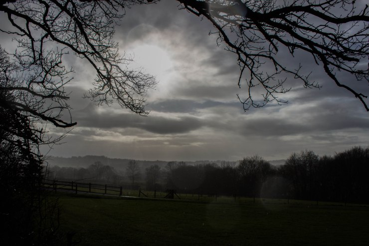
Between the hills there run many small, steep and rushing streams that, particularly in the east, coalesce into rivers that have carved long, broad valleys, with villages perched on the ridges between them. Many of the major roads of this region also follow the ridges, affording wonderful views. These rivers run into what were once large, complex estuaries which have, over many hundreds of years, been reclaimed. The Ashbourne into Pevensey Levels and the Rother, Brede and Tillingham into Rye Bay and Romney Marsh, the complicated and fascinating history of which I will discuss at another time. These levels and marshes form the second of our landscape types. All of Sussex’s major rivers, with the exception of the Adur, rise in the High Weald.


Around the outside of the High Weald lies the Low Weald; a broad, clay plain. Again, the heavy clays do not drain easily and while there is more arable farming than in the High Weald, there is still much less than in most of the south of England. As well there are large areas of ancient woodland, but the rivers are broader, slower and more winding than in the High Weald and the landscape more gentle. There are many villages and small towns and the area is more thickly populated than the remoter High Weald.


Next comes the Greensand: a kind of sandstone that supposedly appears green when first exposed to the air. There is a thin ring of it around the outside of the Low Weald, often with little villages and farms perched on top and up in the north west of the county there is a larger area of a slightly different kind of greensand, known as the Greensand Hills. These contain Sussex’s highest point at Black Down. In character they are much like the High Weald, with small, remote-feeling villages, steep valleys, rushing streams and much woodland.


Beyond a very thin ring of gault clay, as hard as rock, we reach the most famous landscape in Sussex, the South Downs. Made of unimaginable billions of coccolithophores – the calcium shells made by single-celled organisms called coccoliths – these chalk hills run for 100 miles from Winchester to Eastbourne. Once thickly wooded, as everywhere else in England, they were cleared between four and six thousand years ago and grazed with sheep, creating a unique grassland that is the most biodiverse habitat in Europe. As there is no natural water on the Downs, they have never been highly populated, but nevertheless they are rich with archaeology, from hill forts like those at Chanctonbury and Cissbury Rings to thousands of tumuli dotted along the ridge. The chalk of the Downs acts like a giant sponge, soaking up rainwater and releasing it in a line of springs along the bottom of the steep northern slope, giving rise to a long line of old villages, built around the access to fresh water and the soil that, mixed with chalk that naturally washes down from the hills and with lime made from baked chalk dug out of pits, is some of the easiest soil to work between the Downs, making this a rare area of many wheat and barley fields.


And finally, beyond the Downs in the south west of Sussex lies an alluvial plain of deep rich silts around Chichester. This is the best arable land in the county and in times past there were many market gardens here, but over time it has become the most densely populated part of this corner of the world and the large towns have brought most of that way of life to an end. Pagham and Chichester Harbours, though, remain among the most beautiful places in Sussex, despite that.


The story of how this land came to be shaped as it is I will leave for another day, but I hope I have been able to give a glimpse at just what a wonderfully varied land this is. One of the greatest joys of Sussex and the wider South East is how quickly the landscapes and the flora and fauna they support change as you drive about, from the tiny winding lanes of the High Weald to the wide open skies of the Levels and from the precipitous, secret valleys of the Greensand Hills to the great glory of the high Downs, where on a clear day one can see for sixty miles across this fascinating patchwork of green.