I remember once *begins filling pipe-bowl with tobacco* when I was walking on the Cheviots in 2008, I think it was. *packs tobacco down with thumb*. It had snowed heavily for a few days before and the snow was about six feet thick on the tops *puts pipe in mouth* *takes pipe back out of mouth* but on that day, you see, on that day it was beautiful weather. Not a cloud in the sky. Quite stunning, in many ways. *puts pipe back in again* *lights pipe*. Now then *accidentally inhales too much and brings up a lung* the top of the snow *wipes eyes* had frozen into a crust, so if you were careful, you could walk on the top, but if you trod too heavily, you’d go straight through. *goes to put pipe back in mouth, but thinks of something else to say first*
Of course, on the Cheviots *jabs mouth of pipe at the reader for emphasis* the top is blanketed. Blanketed, mark you, with peat bogs, up to six feet deep. Well, you can only imagine what it would be like if you fell through. *puts pipe back in, leans back in wing-backed armchair and puffs contentedly* I fell through, of course.
Fortunately I had a stick I had cut from the hazel coppice at Easton Farm Park and finished with a piece of red deer antler, which stopped me going all the way in. I was halfway up a short, steep hill, some miles from the nearest road. Not another soul had I seen all day, as I walked on the crisp, clean snow beneath bright, sparkling skies of purest blue, light wisps of cloud just gathering about the top of The Cheviot itself behind me – Scotland to my left and England to my right. The right leg went in first, followed swiftly by its companion, leaving me dangling off my stick and praying fervently that I had put the antler on properly, as the integrity of that joint was all that now prevented me from reaching an icy grave that day.
Some pile of rocks or other
I don’t quite know, now, how I did it, but I suppose the adrenaline starts to pump in moments like those and, after a few moments contemplation of my predicament, I suddenly found hitherto untapped reserves of strength, hauled myself out and continued on my way.
*taps pipe out into ashtray*
When I got back into town that evening, all the B&Bs were closed, because the weather was so bad, so I had to check into quite a posh hotel. I chatted up the manager a bit, who I’m pretty sure was Bowling from the Pavilion End, if you know what I mean, and got upgraded to their best suite, with an enormous bed and beautiful bathroom. I bathed in luxury before descending for dinner in an almost deserted restaurant.
Now then. As you may have noticed, this is quite a long walk. The going is pretty easy. They’re not called “Levels” for no reason, but still. 12 miles is a long walk if you’re not used to it. Walking on the 1066 Country Walk section is very easy to follow, but after that navigation becomes much more difficult. Paths are often poorly marked, have locked gates across them that require climbing or are almost impossible to follow. An OS 1:25,000 map of the area (Eastbourne & Beachy Head) is recommended along with the ability to read it. There was a lot of head-scratching and map-scrutinising on this walk.
Farm animals and wildlife:
This walk is almost entirely across pasture and on areas not accustomed to a high density of walkers. Almost all of the fields had sheep, cattle or both, which can react badly to humans and their dogs. As well as this, much of the walk is in the habitat of a great deal of wildlife, particularly bird species, some of them endangered. The disturbance caused by people and, in particular, their dogs, can be severely detrimental to such species.
Moo cows
Basically, be mindful of where you walk and how loud you’re being. And don’t bring a dog.
Right. That’s the finger-wagging done, let’s get on with the walk. This was a different sort of walk for me. In terms of landscape that is – I mean, I didn’t walk sideways, or on my hands or anything. It was still quite traditional with regards to putting one foot in front of the other and everything. No, it was the flatness that made it different.
The Levels are, as the name suggests, quite level. The reason for this is that it’s all reclaimed land. Until relatively recently in geological terms, the whole area was under water, at least at high tides. Indeed, throughout the first part of the walk, you will notice that you are walking towards a line of low hills that stretch along the horizon from west to east in front of you. This is what’s known as the Saxon Shore, which may give you a bit of a clue as to what sort of time period we’re talking about.
Attempts to drain and farm the Levels appear to have started as early as the 8th Century and really got going in the Middle Ages. This was mainly achieved by the expedient of waiting for the tide to go out and building sea walls to stop it coming back in again. This seems to have worked nicely until the “Great Flood” of 1287, which as the name suggests was a flood, and a great one at that. After that time commissioners were appointed to take charge of the drainage of the Levels and this was completed by 1696.
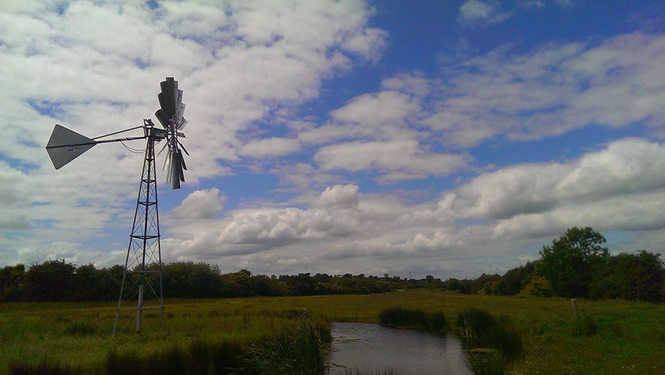
Wind pump
Even before they were drained, certain higher areas never flooded, even at high tides, leaving “islands” among the waves. These islands were known as “Eyes” or “Eys” and this name persists in names such as Horse Eye Level and even Pevensey itself. Indeed, before the drainage, boats were able to moor at Pevensey Castle, which is now some distance inland. Before salt water was entirely expunged from the area, harvesting salt was an important part of the local economy.
Blimey, I’ve written a page and we haven’t even taken a single step yet. Sorry about that. I do go on.
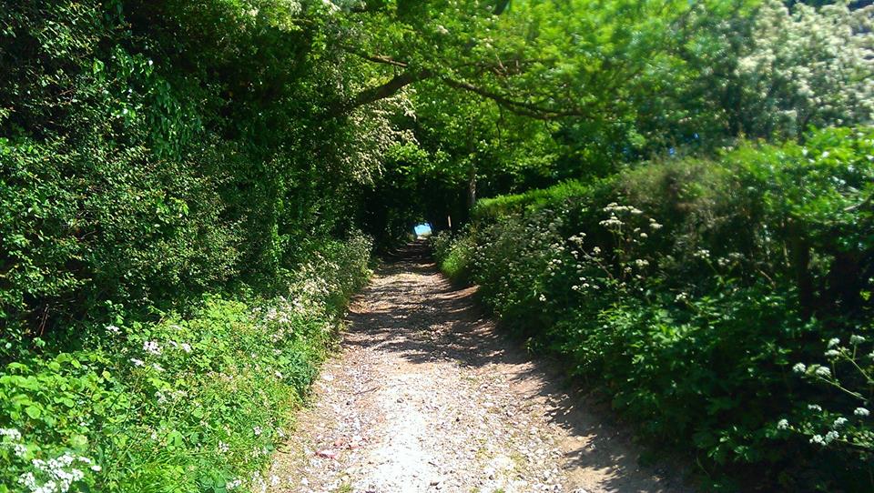
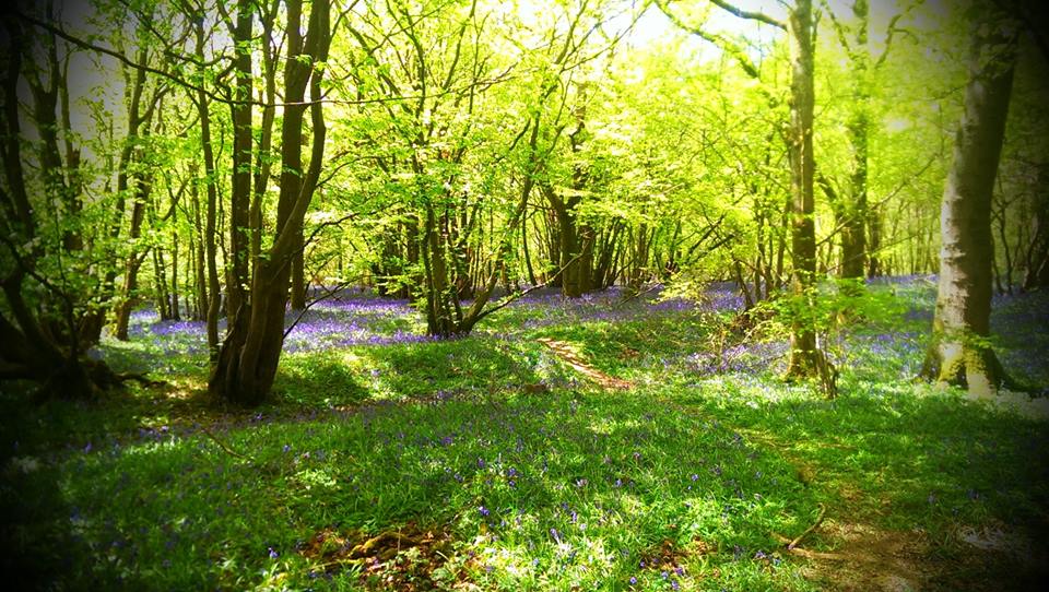
From Pevensey & Westham station, turn right and then right again at the mini roundabout. Turn left onto Peelings Lane, past a little pond on your left. After a short while you will come to the entrance to Castle Farm on your right. At first it doesn’t seem marked, but there is a small footpath sign on a telegraph pole to the right of the entrance. Go straight through the farmyard and over a stile into a meadow. The path is pretty obvious ahead of you and goes straight through a gap in a hedge, then turns slightly to the left – heading towards a footbridge. Cross the bridge, turn right (again the path is obvious) and a few yards later enter a hedgerow where steps take you up a short rise to the edge of Sussex’s attractive A27. Now then, I’m sure you remember the Green Cross Code, but I will say BE CAREFUL. The A27 is very busy and fast, but not a dual-carriageway at this point, so crossable with care. Down steps and through a hedge on the other side and we emerge on our first proper bit of Level. Paths immediately become slightly tricky to see on the ground, but you will see a footbridge ahead of you and slightly to the right. Head towards that – over another couple after that – and you will come to a much more substantial bridge over a rather wider stretch of water. This is Pevensey Haven.
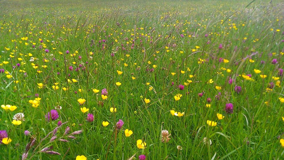
Buttercups and red clover
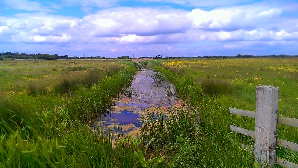
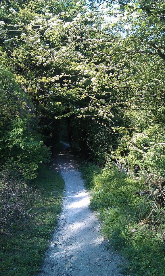
Now, I’m not good at bridges at the best of times, but this one is terrifying. IT BOUNCES UP AND DOWN. Don’t like it. I ventured on to take some pictures, but amidst the sweating, shaking and crying, they didn’t come out very well. Mainly because I was convinced I was going to drop my phone in the river. Thems of you what is also not good at bridges will be glad to know that our path doesn’t actually cross the river at this point, but turns left along the near bank to join the 1066 Country Walk. The path here is very easy to follow alongside the river. A wind pump sings eerie, metallic songs at one point – the meadow next to it deep with buttercups and red clover on the day I visited.
Keep following this path until you pass a barn and get to a cottage on a lane. Turn right and cross the bridge, there are signs at the junction of roads saying you should turn right. Do so and then left, still following the 1066 Country walk. This little place what you have just passed through is called Rickney, which I find impossible to say without doing so in the style of Patsy Palmer bellowing “RICKAAAY” at Sid Owen in Eastenders of yore.
Taken from the terrifying bouncing bridge
I like the sound of this 1066 Country Walk. Perhaps it was something William the Bastard did to unwind a bit after all that brutal slaying and before getting on with his nice little hobbies, like building the Tower of London and the Harrying of the North.
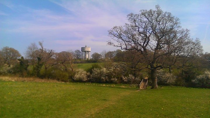
You then follow the path alongside a wide dyke called Herst Haven for a good mile and a half, which gives you ample opportunities to enjoy the wide views. Ahead of you, on the horizon, you cannot fail to notice the white pimple-like dome of an observatory in the grounds of Herstmonceux Castle. This was, until 1990, the home of the Royal Greenwich Observatory and is now a science centre. The castle itself is also open to the public and stages regular medieval events. You can also see the spire of All Saints church, Herstmonceux.
Gate with yellow on
Eventually, you will reach a leaning post showing that the 1066 Country Walk turns to the right away from the dyke. Follow this round a clump of low trees and through a gate onto a green lane between hedgerows. Keep your eyes peeled for a wooden gate on your left with a bit of yellow tape on it. No other markings are apparent, but after a deal of going back and forth, peering at the map and muttering about contours, I ascertained that this was, indeed, the path I was after. From here on navigation gets much trickier. Ahead and slightly to the right you will see a set of gates. Head towards them, pass through, ignoring the marked path that leads off to the right, and follow the path leading diagonally off to the left, which will bring you back to the dyke. Turn right, through a gate and then, on the left, you will see another padlocked and unmarked gate. This is your path and you will probably have to climb over the gate. It is then easy to follow the way-marked path along the dyke to the road.
Entirely unmarked, padlocked gate
Turn left onto the lane, walk past a farm on the right and then turn right through two gates and onto a bridleway, called Marshfoot Lane. Easy going at first, this path follows the charmingly-named Whelpey Sewer before plunging into a thicket of blackthorn, which at times renders the way almost impassable. With a certain amount of swearing, it is possible to get by. This path also features a mysterious third rut in the middle of the track – covered with grass at this time of year, it is almost perfectly placed to turn your ankle. You will reach a crossing of paths, where one turns left across Horse Eye Level. From here on in I found the best way to navigate was simply to look ahead for the next footbridge, of which you will cross many. After a fairly substantial one, you will head into the left-hand corner of a field where various signs will show you have reached a bridleway. Go through the gate and turn right, over a brick bridge and immediately through another gate onto a decent track.
One of several thousand footbridges in the area
Follow the track, with the tower of Hailsham church obvious on the horizon, until the first footpath on the left. The path quickly goes round to the left, over a stile and then heads to the right, towards a footbridge. We’re back to navigating by looking for the next footbridge. After the first one, the path heads slightly to the left crosses another bridge, goes straight ahead and over a bigger bridge, ignoring a path to the right. Straight ahead after this bridge will bring you to a byway. Turn right and then immediately left.
We’re now at Down Level and I nearly got a bit lost here. Yes, even I, your experienced guide can get lost from time to time. That time in Churchill Square Shopping Centre being a particularly notorious example. Also, my battery had gone flat, so I was unable to take helpful pictures, which is a shame. Anyhoo, through the first gate (or maybe I climbed it, I can’t remember) the path can be discerned ahead of you, just. To the left of the end of a fairly wide dyke and then along a narrower one, do not follow the more obvious track round to the right, but keep heading straight on and you should get to a gate with an earth bridge across a ditch. Through that, past a couple of small meres on your left and each bridge was fairly obvious from the last. In the end, you will get to a field surrounded by hedgerows with the roof of a house visible. Head towards it and the path goes through a knackered metal gate onto a road.
Evil
Turn left onto the road and then right just before the next house. I must confess I completely lost the path here, after crossing the nice footbridge, the appearance of which filled my heart with hope that the way ahead would now be easier to find, only to have my hopes and dreams cruelly dashed by the lack of any further way marks. I went through an obvious chalky gap in the hedge to the left after going through a bit of scrubby stuff and being barked at by a dog. I then went straight ahead to a gate that let me onto the road. I am not at all convinced that this is the correct route of the path and neither did I see any further evidence of it from the road. Nevertheless, turn right onto the road, head straight ahead at the junction, ignore the first path on the right and take the second one through a gate and onto a track at Windyridge. This public footpath is marked if you care to search hard enough under the ivy that cloaks the gatepost.
Two for the price of one
Follow the track, which leads to a dead end, slightly alarmingly surrounded by high, locked gates, but never fear. To the left of the gate in front of you is a stile that can just about be reached through nettles. Over that and follow the hedge to your left down into a corner of the field, over a stile surrounded by beautiful trees, turn right and through another gate or over a stile or something, it’s way marked. The path goes through a narrowing gap into a horse field with farm buildings ahead. The path goes all doowacky here as well. It turns right, past a huge mound of chalk and reaches a track. I turned left here and walked through the farmyard, which almost certainly isn’t the right way, but nobody stopped me. I then came to the entrance to a rather fine house called Priesthawes and the marked footpath leads to the left, through the gates and past the front of the house. Follow the drive round to the right and down to a road.
Another ditch
Cross the road and follow the track on the other side, which turns right past the end of a belt of trees. The path then turns left immediately, along the edge of the belt of trees. It’s not way-marked and I had to climb over some kind of peculiar pipe thing, but this is definitely the way. You will come to a large pond on your right, which you leave to your right, following the path on the edge of the field and over a stile. The path then leads along the hedge to your right, with glimpses of the pond through it. When the hedge turns to the right, you turn to your left where the path crosses a stile and is then fenced off along the left-hand side of the field. This brings you to a track and turning left takes you over a bridge across the A27. Straight on at the other side, following an old lane with a new housing estate on your left, through a gate at the end, follow the road straight on to the main road. Turn right. Just past the Old Polegate Station restaurant, turn left through a gap in the wall and follow the road, turning right onto a path between high fences. At the end of this path you will see a particularly attractive car park, Polegate Station and, even more excitingly, a Co-op, from which I immediately purchased a pork pie.
4.24 miles (6.8 km) – About 1 ¾ hours, but see below.
This walk starts from the village of Litlington in East Sussex, which is not served by public transport, as far as I’m aware. The No.12 from Brighton or Eastbourne stops at Exceat for the Seven Sisters Country Park and it’s an easy walk from there to Litlington via the road, the Cuckmere River or through the forest.
Although this walk says it’s only an hour and three quarters, when I did it I was out for about three hours, partly because there’s some lovely places to sit and smoke contemplative roll ups, but mostly because the whole point of this walk was to go and have a look at Lullington Heath, which is Access Land and can be wandered about on at will, so the instructions only tell you how to get there and back again. The rest of your time may be spent gaily tripping hither and yon through the heather. Did I say heather? On chalk downland? More of that in a bit.
Just to the north of the church in Litlington (if the church is on your left, you’re going the right way) there is a bridleway leading off to the right, through a farmyard. Go up there. It turns diagonally to the left, marked by a post, past a barn and then turns right onto a chalk track between hedgerows. Follow this path until you get to Lullington Heath.
Well. That was easy to explain.
Winchester’s Pond
Oh wait, no, there’s more. You will get to a junction of bridleways and a Natural England information board welcoming you to the Heath. To the right of the board is a gate, through which is Winchester’s Pond, an 18th Century dew pond. We’ve done dew ponds before, right? And you remember it all, yeah? Man-made ponds dug to collect rainwater for sheep to drink? Well anyway, this is a particularly lovely one and there’s a bench upon which to sit and catch one’s breath while enjoying the vista. Having just read the information board which said there were newts in the pond, my companion for the day said he could see one – pointing in the vague direction of the pond. After a certain amount of “No, you idiot. There. By the big reed.” I spotted what he was pointing at and, with a small whimper, raised myself from the bench to get a closer look. On closer inspection, what we’d thought was a newt turned out to be a rather handsome grass snake, which was lovely to see. In all my years of wandering about the countryside, I’d never seen one swimming before.
From here we headed vaguely north east and wandered about to have a look at the heath.
Common Sorrel on Lullington Heath
So, what’s so special about Lullington Heath? Put simply, it is the largest and best example of Chalk Heath in the country. And just what is chalk heath? Well, now. In general, there are three types of plants, with regards to the soil types they’ll grow on. Generalists, which will grow more or less anywhere, calcicoles, which like to grow on alkaline soils, such as chalk and limestone and calcifuges, which grow on acid soils such as sand and sandstone. Heath is a community of plants that grows on acid soils. The observant amongst you will have noticed that the South Downs are made out of chalk. So why are there acid-loving plants growing on chalk? Basically, at the end of the last ice age, the water from melting glaciers flooded over the chalk and wore it away until it exposed the underlying clays of the Weald. Such was the ferocity with which this water surged across the landscape, it washed some of this clay up onto the top of the chalk and deposited it there, making a clay-with-flints cap on top of the Downs. Clay is slightly acidic and this was enough for acid-loving plants to get a foothold. Chalk Heath was once fairly common on the Downs, but due to over-grazing it has almost all disappeared.
In many places it is possible to see where there would once have been chalk heath, as the one calcifuge that continues to grow in those places is gorse, that enormous prickly bastard with the yellow flowers and a scent of coconut. Chalk heath is rare because it can be killed both by over-grazing and under-grazing. Over-grazing will trample and otherwise remove the delicate plants, which are barely clinging on in that environment at the best of times; while under-grazing will allow the gorse to take over and shade out those same little sensitive fellas. Only with the right level of grazing can chalk heath flourish, which is what Natural England are attempting to achieve at Lullington. Besides heather and bell heather, over 250 species of plants (both acid and chalk loving) grow on the heath, around 100 kinds of birds visit and about 50 nest there. Only about a third of the heath is actual heathland, with the rest being chalk grassland and scrub woodland.
Common Hawthorn (Maybush) in flower. In May.
Scrub is something a lot of people put a lot of effort into getting rid of. It is regrowth – mostly of common hawthorn, ash and sycamore – that has grown up since grazing became less common on the Downs between the wars. It shades out smaller plants and destroys the grassland. However, there is a place for some scrub on the Downs as it provides habitats that would otherwise not be present, particularly for nesting birds.
Friston Forest
Once you’ve had enough of mimbling about on the Heath, follow the track you came in on until you reach a bridleway on your right, which leads down and round a long, sweeping corner. Eventually, you’ll go through a gate and into Friston Forest. Although, as a Forestry Commission forest, much of Friston is rather boring pine plantations, this bit of it is actually rather lovely, with a great deal of mature beech growing on either side of the broad track. Go straight on at a meeting of several paths and a few hundred yards later take the narrower path into the trees on your right. After 200 yards or so, you will come to a gate into a field. On the day I was there, there was a profusion of early purple orchids just before the gate. Follow the fence to the bottom of the field where the path becomes a chalk track and follow that all the way back to Litlington.
Early Purple Orchids
Once back to the road, a right turn will bring you back to the start point and will take you past Litlington Tea Gardens, which is well worth a visit, should you fancy scones, clotted cream, jam and tea while sitting in a shed – and frankly, who doesn’t?
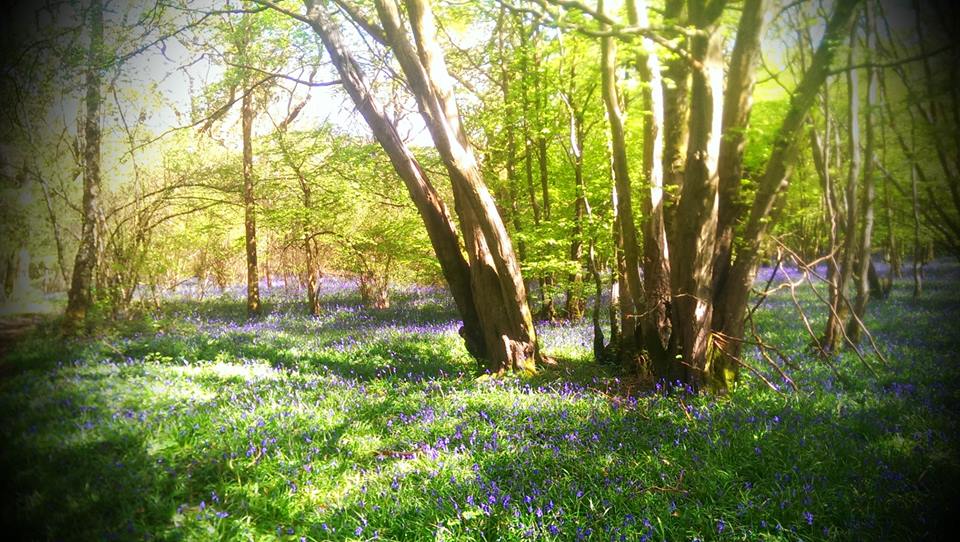
I am, in general, quite pleased about the existence of woodland and ancient woodland in particular. My former lecturer once said to me that “There is no finer place on Earth than an English woodland in the spring” and I am inclined to agree with him. The Arndale Centre in Eastbourne, for instance, is not a patch on a vernal woodland scene which, I rather fancy, more or less proves his theory.
Now, let’s get one thing straight. There is no “Wildwood” in England. I’m sorry, but it is so. Wildwood is a technical term, meaning a woodland that has never been managed by humankind and we have none of it. Some people claim that small patches of the Caledonian Forest in Scotland may qualify, but this is highly contentious and even if these patches do exist, they are too small to be of any real worth. Not only that, but I have it on reasonable authority that Scotland isn’t even in England, so such knowledge is of little use to the residents of Sussex. So when someone tells you they’re feeling spiritually rejuvenated after getting out into the wildwood in the Haywards Heath area, they’re lying.
No, the nearest thing we have in England is Ancient Semi-Natural Woodland (ASNW). “But what defines ASNW?” I hear you ask. In my head. Because “you” are not real and I’m actually sitting alone in a room in Brighton. Well, I’ll tell you. For a woodland in England to be classified as “ancient” it has to have been in existence since at least the year 1600. Many historians may take issue with this definition, what with 1600 hardly being “ancient”. “Perhaps”, they may postulate, “we should refer to it as Early Modern Semi-Natural Woodland (EMSNW)?” Well, if any historian does ask you that, you can tell them from me that that’s a stupid question and they can shut the hell up. The reason 1600 has been chosen is because the practice of planting new woodland before that date was extremely rare, so if it’s been there since the last years of Elizabeth I, then it’s likely been there since woodland first regrew in Britain after the last ice age.
So how do we know if a woodland has been there since 1600? Aha. Aha, aha, well. It’s tricky, innit. Maps are a good start, but not conclusive. It is entirely possible that a wood shown on a map from 1600 could have been cut down and disappeared completely for 300 years and then regrown. In any event maps from 1600 aren’t even the best record of things that were definitely there. Have you seen Jacobean maps of the UK? It’s all the wrong shape and everything. So, a woodland on a map is no proof that it has been there for all this time.
Wild service tree leaves in autumn
Names can also give a clue, so should you encounter something called “New Plantation Wood”, for instance, there might be the tiniest doubt in the corner of your mind that this may not be tremendously old. On the other hand just because it’s called “New” doesn’t mean it isn’t old, like the New Forest, which was created in the 11th Century. Not that the New Forest is a woodland, so that’s a rubbish example. We’ll come to why things called Forests aren’t always woodland in a bit, probably, if I remember. But a nice old-sounding name, like “Brock’s Wood” for instance can be another clue. “Brock” is an old Sussex name for “badger” you know.
But what of the physical attributes of a woodland? I imagine were you actually here you might be crying out to know. The edges of woodland can tell you a lot. Is the edge dead straight? If so, that edge at least is likely to be relatively modern. If, on the other hand, the edge is sinuous, then it’s more likely to be much older. It could be more wibbly-wobbly for the same reason many old lanes seem to sway from side to side – the effect of oxen plough teams which naturally take a snaking path, due to the way oxen walk and have carved out the glorious, circuitous byways of old England – or it could be that the edge follows a stream or something. Plantations created by man are much more likely to have straight edges. Care should be taken, though. CARE. TAKE IT. An ancient woodland could have been cut into to form new fields and, thus, straight edges could be seen EVEN THOUGH THE WOODLAND IS PRE-1600.
Old hornbeam coppice
And what of the edge? What does it look like? Is there a hedge? Traditionally woodlands were edged with hedges to protect some of the game species that lived within, to make it more difficult for poachers to get in and out of the woods and to reduce the effects of wind, rain and general weather penetrating the woods and harming it. The presence of a hedge is another good clue, but, again, by no means conclusive.
You may, by now, be wondering “Well, what is conclusive?” You’ll be delighted, I am sure, to learn that virtually nothing is conclusive when it comes to identifying ASNW! Hooray! Rather, it is a piecing together of evidence to decide whether, on balance, the woodland in question is ancient or not. So stop being impatient and let’s jolly well get on with it, shall we?
A wood bank, with a stumped hornbeam just visible on the left
WOOD BANKS. HAHA! I love wood banks. Wood banks are not, as you may imagine, institutions within woodlands that lend money to squirrels. Heavens no. Wood banks are, in fact, far more similar to cross dykes (no laughing at the back), in that they are a man-made feature designed to delineate boundaries. Yes, a wood bank is nothing more than that marvellous age-old thing of saying “THIS IS MINE AND THAT IS YOURS SO BUGGER OFF”. I seem to be getting awfully shouty. Sorry about that. Wood banks are easy to recognise. They will be long and fairly straight banks of earth (although you may spot remaining fragments as well), will have some evidence (probably) of a ditch right next to them and often go round very obvious corners. They also usually have stumped and pollarded trees on them. Stumped trees have been cut down in such a way that they will grow back all twisted and gnarled and kinda cool and awesome looking. Pollarded trees are trees that have been coppiced, only higher up. The intention being to make it really obvious that this is a man-made border that separates properties.
Have we talked about coppicing yet? We need to talk about coppicing. Coppicing is like pollarding, only lower down.
I jest, it’s ok, I will tell you what both of these things are. Coppicing is the practice of cutting trees down so that they will regrow into clumps of straight, useful poles. Only certain trees will coppice and the classics are things like hazel, hornbeam and beech. It’s even possible to coppice oak and ash, but much less common. Large areas of coppiced hazel and hornbeam are a good indicator of ancient woodland. The width of each coppice “stool” as these clumps are called will tell you how old that stool is – the wider it is, the older it is and sometimes the middle of a stool, especially with hornbeam, may disappear underground, leaving a ring of trees above ground. Some coppice stools are estimated to be thousands of years old and, obviously, if there are a lot of really old coppice stools in your wood, it’s a fairly safe bet that you could be in ASNW. I may do a proper article all about coppicing sometime. Coppicing is brilliant. Pollarding is just coppicing higher up so the deer can’t eat the new shoots and make your poles go all woggly. No-one wants a woggly pole, after all. Pollarding is much less common than coppicing in woodland, which is a relief, because it looks really stupid.
Old hornbeam coppice
And what of oak and ash and beech? Again, if there’s loads of big, old trees in the wood, it’s another indicator that it might be getting on a bit. If, on the other hand, there’s loads of trees that are all much the same height, then it’s likely they were planted, or have regrown from nothing.
And then there’s the actual species present. If the trees are all Norwegian spruce, or even horse chestnut, then it’s not ancient, as neither of those trees were here in 1600. Sweet chestnut (which coppices beautifully) has been about since the Romans, so you’re on a safer bet there. Lots of big old oak, ash, beech and so-on are good. Midland hawthorn (not common hawthorn – you can tell the difference by the shape of the leaves and having more than one style in the flower. Buy a bloody tree ID book), wild service tree, a good carpet of wood anemones, certain ferns (I’m rubbish at ferns) and even mosses and bryophytes can be strong indicators, like anyone ever looks that hard at mosses and bryophytes. Carpets of English bluebells are a clue, but as they’re actually relatively good colonisers, they don’t tell us much. Stronger indicator species are those which spread only very slowly and are, therefore, much less likely to reappear in a replanted, or regrown woodland. Remember! A single example of any of these species does not an ancient woodland make: they could have been planted of have got there by some other freak. The more indicators you see, the more likely it is that you have found an ASNW.
Sinuous woodland edges
Eventually you start to develop a feel for it. As soon as you walk into an ancient woodland the air feels different (this paragraph may be a bit less scientific, but sod it). A quick look around at the general mix of trees. Are the paths straight, or do they wander amongst the coppice? Does it feel like something that’s been planted, or does it feel… old?
Hazel coppice
When you walk in in the spring are there great carpets of beautiful anemones and celandines and bluebells? Are there banks of wild garlic by the streams? Does the air ring with the calls of many different birds and the thrum of woodpeckers making their presence felt? Does the air speak of mystery and age-old work? Traditional woodland management more or less ceased in the UK between the wars, but the evidence of thousands of years of man’s influence can be seen all around you. The scars in the earth where men laboured to build wood banks and protect their masters’ properties. The gnarled and twisted hornbeams – cut with care. The beautiful patchwork of hazel – home to dormice for centuries. Beech coppice that took 200 years to regrow. Oak allowed to grow over the coppice to provide building material that could take 300 years to reach useful maturity.
Ancient Semi-Natural Woodland in this country has evolved alongside humanity – has been worked by humanity for thousands of years. Everything had a use, from the hazel used to build wattle in the walls of cottages to the hornbeam used to make charcoal for smelting iron. The oak that built Elizabeth’s navy, or the ash that made the handles of the tools used to work the harvested wood. An ancient woodland is a beautiful sight indeed, but it is far more than that. It is a record of those who came before us and built the world we know now. Of those who toiled, poached, crafted, innovated, created and cared. Walking in the woods is not, for me at least, just a nice place to be; it is a connection to history.
OH WAIT. FORESTS.
Ashdown Forest
I said I was going to explain why forests and woodlands are not always the same thing, right? And then I forgot. Having received various veiled threats and several outright ones, I am now going to do so. Forests in the old meaning of the word are royal hunting preserves, not woodland. Areas such as the New Forest were “afforested” and converted to “Royal Forests”, which had their own set of laws designed to preserve the hunting for the royals.
Friston Forest
These forests were rarely more than 50% woodland, but over time the word “forest” has come to mean “extensive woodland”, with Forestry Commission forests, for instance, being entirely wooded. Confusing innit? Ashdown Forest in Sussex, for example, is a former hunting forest and is made up of a majority of open heath, with some wooded areas, while Friston Forest – also in Sussex – is entirely wooded. Welcome to the wonderful world of the English language.
Since the first arrival of modern man, the South Downs and Blackcap in particular have changed considerably. When humans first arrived, after the last ice age, the Downs were covered by forests, principally made up of Small-leaved Lime. Mankind began to clear the forests and make his home on the chalk hills. He found fertile soils in the dry valleys and learned how to turn them with rudimentary tools. He began to plant arable crops and settled down to tend them. Around him, he took what nature provided and tamed and domesticated the flora and fauna available to him. As time went on and his skills increased, he made tools of flint and bone and decorated beakers by impressing them with combs. Art flourished at Ashcombe Bottom. Eventually he discovered bronze and developed even greater capacity to farm and hunt. He built barrows to honour the dead along the ridge of the Downs and he scraped them clean to the white chalk to show his power to others.
The Romano British grew crops in the lower chalk and grazed their sheep on the Downs. Shepherds would drive their flocks onto the arable fields at night, folding them there so that their manure would enrich the land. He created trackways called Bostalls that wore ever deeper into the face of the North Scarp of the Downs. The sheep stripped the nutrients from the Downs and released them in the Weald. The Downs grew ever more diverse in their flora as each plant sought its niche. In Anglo Saxon times, he moved down from the hills and onto the lower chalk at the foot of the scarp. He built villages and churches, many of which still exist today and he cleared the Wealden forests and planted his crops there, tilling the heavy clay with his new iron ploughs.
As civilisation grew below, the sheep continued their steady work. The soil of the Downs grew ever poorer as their owners grew richer from the wool trade. By the eighteenth century it was believed that a man could walk from Winchester to Eastbourne on the backs of the sheep, which seems a slightly peculiar thing to want to do.
At some point a mill named Blackcap Mill had been present on the site. It is not known if the Mill were named after the hill or vice versa.
In the 1830s someone planted a copse of trees on top of Blackcap. It may (as local folklore suggests) have been intended as a guide for smugglers, or it may have been planted to celebrate the coronation of a new queen, Victoria. Certainly it seems to have been replanted in honour of our own Queen Elizabeth II.
Blackcap Top Bostall
Between these two queens, something happened to the Downs and to the world. With easier and cheaper transportation about the surface of the globe, sheep could be more inexpensively reared in New Zealand than on the South Downs. With ever better fertilisers available commercially, no-one needed to fold sheep on their fields at night. Sheep farming declined and with the introduction of myxomatosis, even rabbits stopped grazing the tender shoots on the hills. Hawthorn, Sycamore and Ash began to encroach on the rich grasslands.
World wars broke out and people needed food. Ploughs were used on the downs. Hundreds of archaeological features were destroyed and thousands of acres of four thousand year old, herb rich grassland was lost. Even as late as the 1980s, ploughs were used between Blackcap and Ashcombe Bottom. The improved soil favoured larger, more aggressive plants and the old downland plants could no longer compete. Many would never recover.
Scrub Woodland on Blackcap
Hope existed, though. On the top of the ridge, where the ploughs never reached, rare and wonderful plants clung on, waiting for better times. In 1993, Blackcap was bought by the National Trust. The surviving remnants were protected, the encroaching trees checked and sheep returned to work their patient magic on the grassland.
An aerial photograph taken in 1991 shows a divided hill top, A rich green showing to the south of the path and older, paler greens to the north. Today, with careful management it is hard to tell the difference with first glance. The rare plants too are coming back to their old territory.
Blackcap is a rare and important area on the South Downs. Chalk downland is internationally rare and sites like Blackcap are invaluable for preserving plants and animals that would otherwise suffer terribly in this modern world.
So what of the future? Ostensibly, the protection offered by National Trust ownership should allow areas such as Blackcap to flourish, free from harm. In reality, the truth may be rather different.
Blackcap from Novington Bostall
With rising sea levels and an increasing population, the pressure to build on higher areas like the Downs, or, possibly plough them up once more, may become too high. Human needs will always be placed above those of wildlife by human policy makers. What will become of the Downs once the Weald has turned to sea?
A Quick Note on Names
The original name of Blackcap appears to have been Mount Harry, while the hill now known as Mount Harry was called Lewes Beacon. Local folklore has it that Henry III stationed his troops on Mount Harry (Blackcap) during the Battle of Lewes 1264, but this is dismissed by Dimmock, Col (1934) as being impractical considering how the battle with Simon de Montfort played out.
Mount Harry from Blackcap
Nevertheless, this appears to be where the hill acquired its name. At some point Lewes Beacon (where a replica beacon stands today) became known as Mount Harry and Blackcap gained its contemporary name. It is not known whether Blackcap was named after the cap of trees that were planted upon its summit, which often appear to be black against the sky. At one point there was a mill at the bottom of the dip between Blackcap and Mount Harry and in a perambulation of Combe Down dated 1772 there is a reference to “the place where Black Cap Mill formerly stood…” Whether the mill had a black roof and derived its name from that, or whether it took its name from the adjacent summit is not known
I start this walk from the Downs Hotel in Woodingdean. You can stay on the No. 22 and get off at Balsdean Road if you like, but there’s a Co-op on Warren Way and I am not a man to pass up the opportunity of an exotic new Co-op. So this walk starts with that awed moment as you first enter an unfamiliar Co-op. “Where will the crisps aisle be?” “Will there be any of the posh sandwiches on offer?” “Do they have self-service tills?” All these questions and more run through your mind as you step through the hallowed portals, membership card clasped to the bosom. My tastes for the finer things in life now thoroughly sated, I then walk up Warren Way and Balsdean Road.
Opposite the end of Balsdean Road is a metal gate, which can be squeezed past (it’s marked as a public footpath on the map) and leads up between houses on the right and a play area on the left. I know it’s tempting, but you must resist the opportunity to sit on one of them rabbit on a spring things, beguiling though they are. All that bouncing back and forth and such. NO! Leave these items of devilry and continue up the path with your head held high. At the top of the path, turn right at the crossroads and walk along the path with gardens backing onto it, peering through the fences and going “Ooh” where possible to do so without being noticed. Beware on this path, as there is a more than average chance of being mown down by a cyclist, some posh bint on a horse or severely mauled by a yorkshire terrier, one of which left my dignity and my turn-ups in tatters.
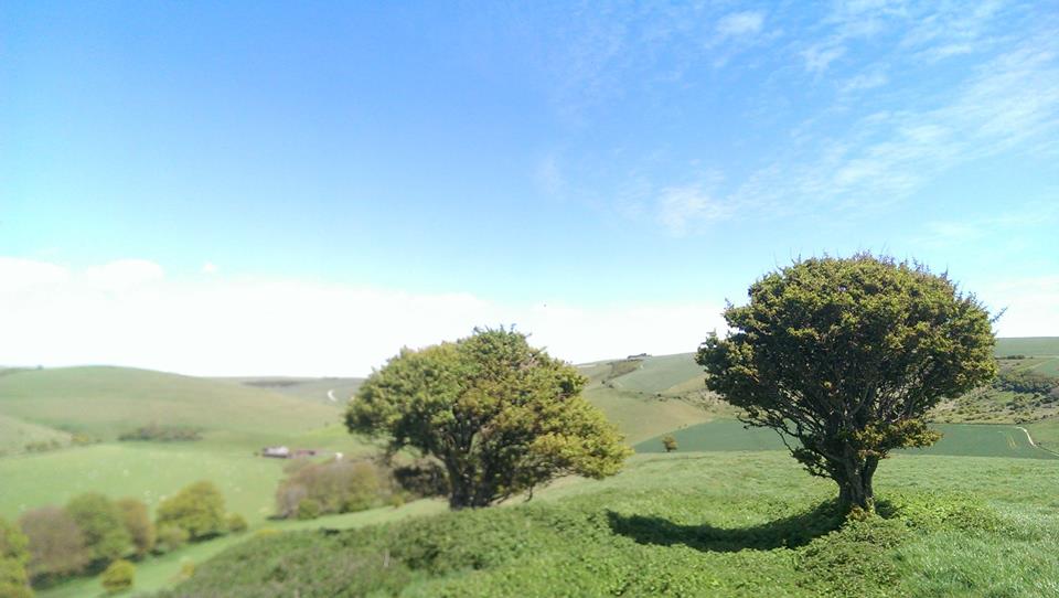
Some Trees
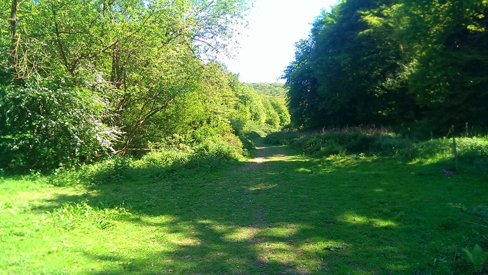
After a couple of hundred yards or so, which should probably be in metres these days, but just deal with it. THEY’RE VIRTUALLY THE SAME ANYWAY. You will come to a gate and will see two paths ahead of you. The right-hand chalk path is to be avoided. I am told that dreadful things happen to those who tread that path. You could end up in Rottingdean for a start. No. Take the left, grassy fork that leads gently downhill and round to the left. Follow the bostall all the way down to the bottom of Standean Bottom, where several paths meet in the shade of a few large ash trees and take the right-hand path, almost doubling-back on yourself.
Unfortunately, much of this walk leads through cultivated land, so wildlife is much reduced. Until the 1940s, the traditional method of farming on the Downs was grazing sheep, but with the coming of cheap lamb from New Zealand, the bottom fell out of the market for UK sheep (which is an entirely different thing to the bottom falling out of an actual sheep, which can happen and an alarming thing it is for all concerned, as I’m sure you can imagine) and grazing declined. With the coming of war, much of the dip-slope of the Downs was ploughed up for the first time, destroying 95% of the chalk grassland in the UK. These crops, then, have to try and grow on strongly alkaline soils and require huge amounts of man-made fertilisers to even hope to survive, but such was the desperate need of this country to try and provide food during rationed war time.
Looking Towards Balsdean Bottom
Did I say “dip-slope”? Why, I believe I did. “Is it time for a quick lesson in topographical nomenclature” I hear you cry? Why yes, I think it might be. The Downs are broadly separated into three bits. The dip-slope, scarps and the cap. Basically, the dip-slope, far from being an incline covered in taramasalata, is the more gentle slope leading towards the sea. The scarps are much steeper and face the Weald or the rivers, having been carved out by melt water or, in the case of the rivers, by wind gaps. A wind gap is not, I am distressed to report, an inter-prandial opportunity to break wind, but a gap in the Downs worn away by the effects of weather. In between these, on the top of the Downs, is the cap. Most of the Downs have a very thin soil over the chalk, but the cap has an extra layer of clay with flints. My former lecturer tried to explain this using an overly-convoluted metaphor involving jelly and stirrup-pumps filled with custard (which frankly brought up more questions than it answered), but just take it from me that some of the clay from the Weald has ended up on top of the Downs and we’ll all get on with our lives.
A Peculiar Thing
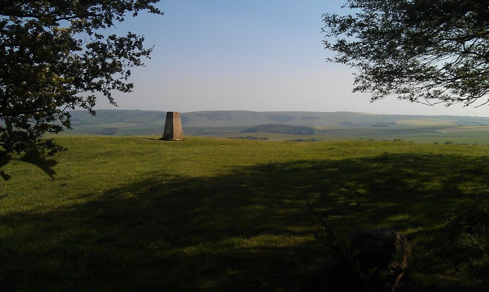
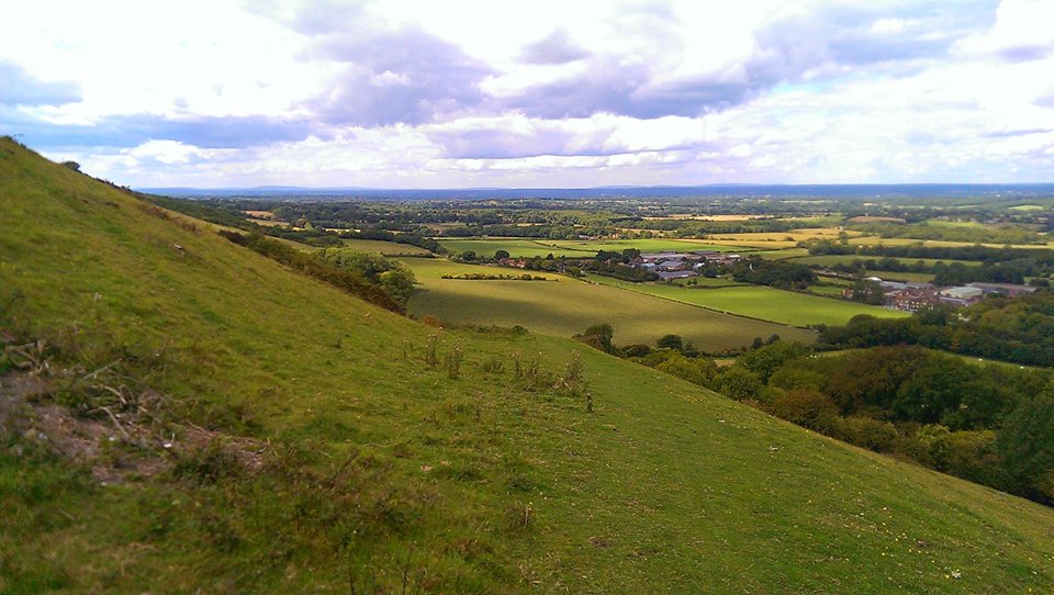
Now, where were we? Ah yes, walking along a gently undulating path which will, eventually, come to a gate, through which a path leads to the left. Follow this path down a hill and up a hill, pass some shrubbery and you’ll come to a footpath sign and a wide chalk track leading up to the top of the hill on your left. Follow that, past the peculiar things dotted along the edge of the path, which are either some kind of satanic offering, or – rather more boringly – way-markers for when it snows. Past the barn at the top of the hill and the path becomes a concrete track, which after a few hundred yards turns ninety degrees to the right. At this point, I walked a little way straight ahead and over a stile into a field, where all of East Sussex was laid out at my feet. Lewes, Mount Caburn and Firle Beacon can all be seen and, on a clear day, you can see for forty miles or more. An excellent spot to enjoy a Co-op sandwich if ever there was one.
Rodmell
Once you’ve had your fill of this view – and on the beautiful May afternoon I was there it was hard to tear myself away – retrace your steps to the concrete track and follow it gently downhill. After a fair while you’ll reach a crossroads with your way ahead through a gate and over a low hill. A sign tells you that you will pass over the meridian, which is tremendously exciting, I’m sure you’ll agree. The path will bring you between fences and gardens and then to a tarmac lane. There is a sign here bearing the legend “To The Pub”. Follow it. Always follow signs that say “To The Pub”. The road leads down to Rodmell and the Abergavenny Arms. Cross the main road, stop in the pub if you wish, and then follow the road to its right. You will pass the Monk’s House on your right, former home of Virginia Woolf and now a National Trust property. Soon you’ll get to walk alongside the bit of river she drowned herself in! Hooray!
A Ditch
The wide track is easy to follow. There are some charming pylons to admire and some ditches full of things that live in ditches. Take a moment in this sudden flatness to turn and look back at the scarp of the Downs behind you, on top of which I, your dear guide, once ate a salmon and egg sandwich that was on offer in Woodingdean Co-op. Ah, the mysteries of life.
River Ouse
At the end of this track is a large bank crossing your path. Climb up this bank by all means, but don’t walk straight ahead, or you’ll fall in the river and suffer the same fate as Ms Woolf. Turn right along this bank until you reach a bridge, which you cross to get to Southease station. When I arrived at the station, I was being followed by a middle-aged couple, the gentleman of which loudly declared, upon seeing the station: “What’s this then? Some kind of car park?” they then boarded a train to Seaford, which says everything you need to know about Seaford.
A beautiful, warm spring day in God’s own Sussex. A gentle breeze ruffling the prodigious barnet as I alight the train at Burgess Hill, I set forth with a spring in my step and a certain amount of joy in my heart. The destination is Plumpton Station in the village of Plumpton Green, via the wonderful woodland of Blackbrook Wood.
Turn right out of the front entrance of the station and then immediately right again through the car park to join the footpath that runs alongside the railway track.
As paths beside railways go, the track from Burgess Hill station is something of a delight. Celandines and lesser stitchwort adorn the edges of the wooded path, the blossom of the blackthorn thick in the hedgerows. The path soon leads out of the town and fields open up on the left, where a public footpath leads across open fields heading more or less south west, through a path slightly incongruously lined with fairly recently planted trees, across a rather fine footbridge courtesy of the local Monday Group volunteers (purveyors of Sussex’s ponciest stiles and bridges) and up towards and then to the right of a prominent white water tower. The path then leads along a private road flanked by the grounds of Weald House, crosses a lane and then along another private road, through meadows, new woodland and between horse paddocks before a bank of celandines peeking through the hedges announces the arrival at a main road. Turning left along the road and just past the houses is a an entirely unmarked gate leading to a path across a meadow, over the railway by a brick bridge and then across another meadow with large oak trees dotted hither and yon. The path leads to a pretty little group of cottages on the far side and turns right along the far end of the field, along the side of another field (which I shared with a red kite for a while) and then comes out at a road junction, just past which is the entrance to Blackbrook Wood.
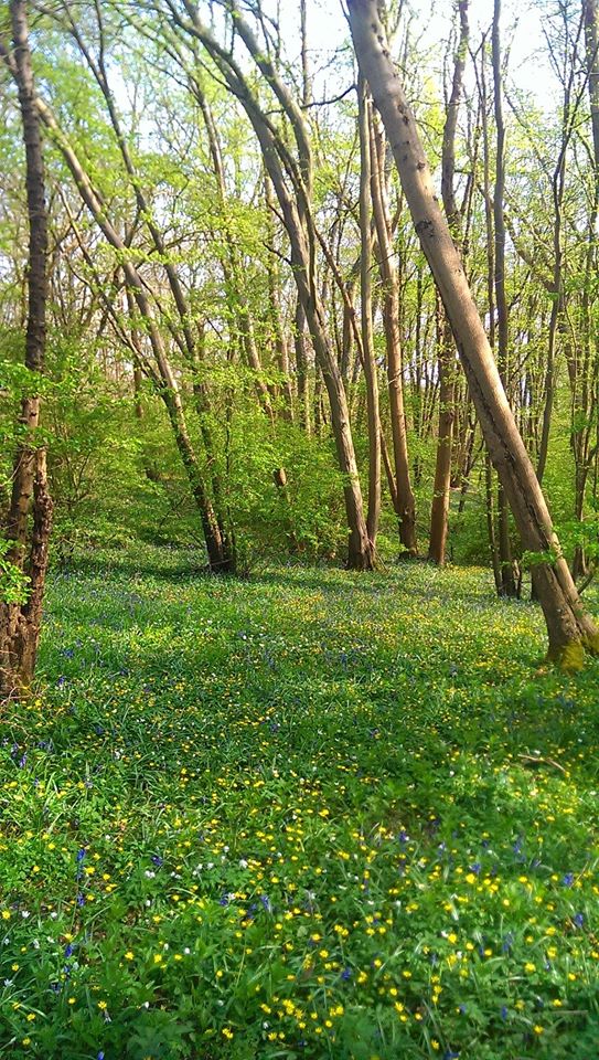
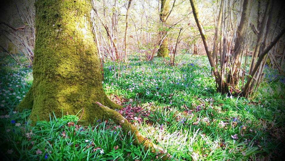
Blackbrook Wood is private land and its many paths can be wandered at your own risk. I didn’t tell you they were there, right? In fact, I don’t even know what paths you’re talking about. The main public footpath is clearly marked and easy to follow, but many hours can be lost simply wandering through the extensive hazel and hornbeam coppice. On my visit today the anemones were in full bloom, forming astonishing carpets and studded with copious celandines. Bluebells also carpeted and mingled with the anemones, but not yet fully in flower. Another week… I shall be back. I make no bones that this is by far my favourite patch of ancient woodland in Sussex and in late April and early May it is simply stunning. The carpets of flowers, the tiny paths weaving through the hazel and the beautiful, elegant hornbeam stools. The fresh new leaves opening on the hawthorn, both of the common and midland varieties, the latter an ancient woodland indicator species and talking of which, other indicator species abound, such as wild service tree, field maple and spindle. The path briefly leaves thick woodland at the other side of Blackbrook Wood and a gate affords a wonderful view of the South Downs, the high point directly in view is Streat Hill. The deeply rutted path, bordered here by primroses, herb robert, stitchwort and cuckoo flower soon plunges back into dense woodland with carpets of interspersed anemones, celandines and bluebells. At the further edge of this woodland the path reaches a crossroads. Although our way goes straight ahead across meadows, it is worth, as this time of year, taking a momentary detour along the southerly path to right. The bank here is a true delight, being smothered with primroses and bluebells and, on the day I was here, nearly fully open early purple orchids. Again, I shall be back soon to see them in their full glory.
Back to the path to Plumpton and the way is reasonably easily followed across a succession of meadows and paddocks, although the old, low, concrete footpath sign is difficult to spot at the white metal gates of a farm, but don’t panic, you do want to go through these, follow the path, climbing over the slightly odd bit of orange bailer twine that appears to want to prevent crossing another fine example of slightly overly-complicated stile courtesy of those fine, pedantic and, one suspects, slightly bored folk at the Monday Group. At Shergolds Farm, turn right onto a broad green “lane” between hedges, cross the farm drive and take the footpath on your left. Otherwise, it’s an easy walk along a path commanding fine views of the South Downs, which later becomes a track and then a metalled lane that brings you into Plumpton Green by the shop. Simply turn right here and it’s a couple of minutes to the station.
Turning right out of my front door, I walked down to Hartington Road. I’m too far down Totland Road to be able to see the views of Hollingbury Camp that can be admired from the top, but I consoled myself with enjoying the rather wonderfully OTT Victorian gothic entrance to “Brighton and Preston Cemetery”. Not only that, but there was a Citroen DS parked opposite at the bottom of Bernard Road. Gold in colour, which is not my favourite colour for a DS, but still rather gorgeous nevertheless.
Classy Salon
Next on the left is what I can only describe as a true work of 20th Century genius. On the corner of Hartington and Whippingham Road is, possibly, the world’s shittest-looking hair salon. I’ve never seen it open, which is a shame, because I’d like, one day, to sample the delights of sitting in a cheap plastic chair grouped around a Calor Gas fire while I wait for someone to cut my hair who can, apparently, according to the pictures in the windows, only do styles from around 1984. At least, I’m sure Sharon from off of Eastenders had that kind of do in 1984 anyway. All is not lost, though! A sign in the door proudly claims “Can’t get here? I’ll come to you! (Saturday mornings only)”. I can barely contain myself.
Mysterious Portal to a Better Life
Moving on from here, the excitement only ramps up further as one approaches the bus stop where the mysterious 37b calls on its way to somewhere called Meadowview. I have not, as yet, ascertained where this mythical Meadowview may be, nor why it’s served by a Compass Bus instead of a Brighton and Hove one, but there’s always people on it. Maybe one day I shall throw caution to the wind and leap upon it shouting “TAKE ME TO THIS PARADISE THAT YOU CALL MEADOWVIEW MY GOOD SIR” which is, I believe, the way that one talks to bus drivers. Who knows what glories may lie there? It could be a whole new life.
Alarming
Steady yourself, though. Hold you hard, as they say in Suffolk, although in a thicker accent than I am prepared to attempt via the medium of type, especially with ladies present. We come now to the Lewes Road itself. Turn left at the aquamarine sign on the alarmingly-named “Skinner’s Funeral Home” and all of life opens up before you. There’s a Turkish shop which I’ve never been in despite a vague nagging sense that everything in there would be better and cheaper than the Co-op, but you wouldn’t get your divi, would you? Got to get your divi. Even if they didn’t bloody pay it out in 2014. If they don’t pay out in 2015, I’m bloody going in the Turkish shop and see if I don’t. Next there’s a Morrisson’s. Not the same down here as in the North, Morrisson’s. The big ones have a good fish counter, but not the small ones, no. This, of course, is a small one. AND they built it on that community garden that some hippies made happen on an old petrol station, so knickers to Morrisson’s. Eschewing that, the Co-op is next door and on your right. Bear in mind that, even if you only popped down for some onions and a loaf of bread, you will still spend at least £20.
The Promised Land
The return is an exact copy of the way there, only backwards. I mean, don’t *actually* try walking all the way up Hartington Road backwards or you’ll do yourself a mischief.
I am starting, insofar as one ought to start somewhere, or so I am given to understand, presumably because not starting anywhere can be terribly confusing for the reader, in Lewes. It seems fitting, somehow, to start in the picturesque, anti-catholic and strangely devoid of decent tearooms, county town of East Sussex. It’s a funny old place, Lewes. Not least because of the annual catholic-burning carnage in the streets. If it’s societies, pressure groups, Guardian-reading yoghurt-knitters and local action groups you’re after, then Lewes is the place for you. It’s also the place for you should you harbour a liking for precipitous high streets, interesting looking bookshops, some quite excellent pubs, a castle I’ve been meaning to have a look at for at least five years and some really rather marvelous Downland scenery.
Let’s pause a moment and have a little geological history, shall we? I can tell you are itching to know what has brought Lewes to be nestled in such an enviable position. Some considerable time ago, like even before there was BBC2. I mean really. Loads of time ago. Actual millions of years ago. The whole of Sussex, the Far North (AKA Surrey), much of The West Country (Hampshire) and the Badlands of Kent formed a large, shallow bowl filled with a lagoon, initially freshwater, then brackish, which always sounds like something Alan Bennet would say about someone “Oh, he was terribly brackish today” he might say about a man standing on a small hill in Leeds.
In any case, this here lagoon was filled with tiny little fellas called coccolithophores, which is a catchy name, I’m sure you’ll agree. Coccolithophores are single-celled algae, which can produce something called coccoliths. These are single plates of calcium, which they fuse together and wrap around themselves in an exciting form of dress know as a coccolithosphere. “Phwoar, would you look at the coccolithosphere on that coccolithophore” you might hear one say to another at a coccolithophore bar. So anyway, these little calcium-covered chaps proceeded to die in their unimaginable billions and trillions and float down to the bottom of this lagoon of ours, eventually covering the clay and sand bed. Over millions of years, this covering built up to hundreds of feet thick and, under the weight of it all, became chalk.
I don’t know about you, but just writing all that made my head hurt. That’s the difficult bit done, though. It gets easier from here. I’m going to make a cup of tea to celebrate.
Now then (sips tea) the next thing we need to care about is the arrival of India. And I’m not just talking about the tea. Once upon a time the Indian subcontinent was a lonely, yet carefree subcontinent, drifting alone and wondering if it would ever find itself a nice continent to smack into with extraordinary force. As luck would have it, just such a continent was waiting for that very thing to happen to it. Not only did Eurasia feel it was lacking something in the pointy-triangular-bits-hanging-off-the-bottom stakes, it also knew it could do with some exciting new lumps and bumps to make Africa jealous. India provided both of these.
It ploughed into Eurasia with such force that it threw up the highest mountains in the world, the Himalayas, and, like a ripple running from an enormous pebble thrown into a puddle made of billions of tons of rock, a vast dome of chalk stretching from Dorset to Champagne. Our coccoliths suddenly found themselves several hundred feet higher than they had been, enjoying the fresh air and the view and just about ready for a lovely Ice Age, or Glacial Maximum, as they like to call themselves, the snobs.
At the last Glacial Maximum, the ice sheets and glaciers covered much of what was to become Britain, reaching as far south as North Finchley tube station. They would’ve come further, but they couldn’t afford a ticket to Zone 1 and glaciers don’t much like crowds of tourists anyway. Our chalk dome wasn’t covered by the ice sheet, but it was affected by vaguely filthy-sounding “peri-glacial activity”, which basically means it froze solid. Although not actually covered in ice, the ground froze in permafrost, the whole area became distinctly tundra-like, the temperatures were described as “right parky” and house-prices fell sharply, much to the dismay of the Daily Mail.
Eventually, some 10,000 years ago, before even the old Queen Mum was born, may she rest in peace, the ice melted. And it melted quickly. Great rivers of melt-water surged across the land, running down to a lower area that later became the Rhine Valley and, even later, the English Channel. Such was the force of the water running over the porous chalk, that vast areas of it were washed away. The middle of this huge dome dissolved and eroded away until all but the very edges were left, the old clay and sandstones being revealed as it departed. Those edges now face each other across the Weald and are known as the North and South Downs.
Let’s finish off this geological history with a reasonably swift canter across the landscape zones of Sussex, shall we? You will be astonished by how useful this information will be to you. Indeed, you will wonder how you ever got through life without a decent working knowledge of the landscape zones of Sussex.
Sussex can be split up into, erm… (counts on fingers) five separate zones. A low lying alluvial plain in the south west of the county made up of deep, rich silts washed down the rivers and deposited giving rise to large numbers of market gardens and providing a platform for some of Sussex’s less pleasant towns. The South Downs which I have already explained at great length and if you can’t remember it all, then I am disappointed in you. The heavy clay soils of the Low Weald and the higher, rolling, thickly-wooded sandstones of the High Weald and finally the unnatural weirdness of the Levels in the south east of the county, land reclaimed from the sea, notably around Pevensey.
It is, I am sure you are excited and even proud to learn, my intention to visit at least one tearoom or garden in each landscape zone and then write some kind of pointless diatribe about its quality and some interesting and useful facts about the landscape around it.
Sussex is by far the best county in the South East of England and anyone who tells you otherwise is a liar, particularly if they’re from Kent. Come with me now as I, starting with Lewes, take a jolly stroll across this incredibly varied, beautiful and beguiling landscape.
In the steep hillsides above Fulking there lie deep scars, criss-crossing the landscape. The V-shaped depressions known as bostalls are a familiar sight all along the Downs and on Fulking Escarpment in West Sussex there is a particularly spectacular collection of them, which between them tell a story of the long history of the Downs. When people first came back to what would eventually become Sussex after the end of the last Ice Age, they started clearing the forests on the top of the Downs and using them to graze sheep. Starting around 6 thousand years ago, the Downs were almost totally cleared by around 2000 BC and sheep have been grazed there ever since – reaching a peak in the 17th Century. Alongside this grazing, arable farming also grew up in Sussex. The clays of the Weald are too heavy and waterlogged to be easily cultivated, even with iron ploughs and the soils on top of the Downs were too thin and alkaline to be of any use to those early farmers. But along the bottom of the Downs, where the chalk and the clay meets and mingles, the soil is lighter and it is possible to plant crops there. To help fertilise the fields, the sheep grazing on the Downs during the day would be lead down to the arable land to spend the night, where their droppings would improve the soil. The soil of the Downs being very thin, it quickly wears away under the feet of thousands of sheep allowing rain water to run across the surface of the chalk beneath, which soon erodes to form the deep tracks we see and still walk today – some of them a thousand years old.
2. Lynchets
More evidence of early farming activity on the Downs can be seen in the form of lynchets (sometimes known as strip lynchets), particularly around some of the dry valleys of the dip slope (the more gentle southerly slope of the Downs running down towards the sea). These long linear features were formed when old ploughs turned the soil, which then crept slowly down the hill, forming shelf-like platforms. Opinion is divided as to whether this was simply a side-effect of old-style ploughs – which turned soil only one way – or a deliberate act intended to better retain water on the hillsides and to provide flat terraces to be more easily worked.
3. Terracettes
Terracettes above Kingston near Lewes
In some ways like a smaller cousin of the lynchets, terracettes, despite sounding like a 60s backing group (In fact, I’m thinking of starting a band called Strip Lynchet and the Terracettes, but that’s for another article), are in fact long step-like formations on the steeper parts of the scarps of the Downs, created as a result of soil-creep and the action of grazing animals walking across the face of the hillsides. The poor, crumbly soil of the Downs (called a rendzina soil) easily washes down the hill, but collects around the base of the grass, which in turn provide a foothold for the wandering cattle and sheep. As they tend to walk along the face of the Downs, rather than directly up and down the steep slopes, they soon walk the soil into the form of terracettes.
4. Chalk Pits
A chalk pit near Lewes
While wildlife across most of the Downs is adapted to surviving in extremely exposed situations, the numerous chalk pits provide some shelter and a range of ecological niches that would otherwise not be seen. Chalk was dug out of these pits before being baked in kilns to produce lime. The lime would then be taken into the fields below and ploughed in – both to address creeping acidification of the soil and in an attempt to make the heavier clays light enough to plough. Once a chalk pit had been abandoned, it often became a haven for wildlife, giving shelter for more delicate species and allowing scrub woodland to grow up (an unfamiliar sight on the Downs before the latter half of the 20th century), providing yet more habitats to be filled with life.
5. Dew Ponds
Dew Pond above Keymer
Since at least Saxon times and possibly much earlier, people have got round the lack of natural water on the Downs by constructing dew ponds. The chalk being highly porous, rain water quickly soaks away, leaving nothing for sheep to drink. In order to catch and retain rainwater, these perfectly circular, saucer-shaped ponds were dug, lined with chalk and puddled clay and left to collect their essential bounty. Like the chalk pits, these man-made features provide habitats that would otherwise not be available on the Downs. Some of the better-maintained ponds even have great-crested newts in them, despite being some distance from the next nearest stretch of water.
6. Hangers
Less common in the eastern part of the Downs, steep, wooded hillsides known as hangers proliferate as you go further west towards the Hampshire Downs. Studded with enormous, beautiful beech trees, these woodlands also contain a great deal of ash, which grows like a weed on the Downs and some of the oldest, coppiced trees of the area – small-leaved lime trees, remnants of the original forests that once covered the hills, before the coming of people and their sheep. In other parts, shepherds planted areas of coppiced hazel to provide wood for making their hurdles to control and pen the sheep during shearing.
7. Coombes
Some of the steepest slopes on the Downs are found at the top of these deep, bowl-headed dry valleys. The terracette-lined slopes were carved out by melting water at the end of the last ice-age and now provide some of the best-preserved stretches of calcareous grassland in the area, as it was impossible to plough up and “improve” them – in comparison to the flatter areas on the dip slope that were lost forever under arable fields in the 1940s, when the pressures of war required a great effort to produce more food from the landscape – made possible by modern ploughs and fertilisers. These unimproved tracts of grass, therefore, provide habitats for some of the rarest plants in the UK.
8. Bottoms
Stump Bottom. Hehehehehe.
Where the coombes widen out, the soil washed down from the steeper hills collects, to form deep, easily-worked and fertile soils and it was here that some of the earliest farming communities formed when humans came back to Sussex after the ice receded and the tundra which covered the Downs thawed. The Beaker People lived here before the coming of the Iron Age and the Celts, but ultimately the lack of natural water in the bottoms forced people down into the Weald, where drinkable water emerges from under the Downs and flows into the rivers.
9. Archaeology
Chanctonbury Ring
The Downs have always enjoyed a strategic importance in the wider landscape giving, as they do, commanding views over the Weald. It was a powerful person who could claim control of the Downs and in prehistory they built hill forts, with gleaming-white chalk embankments that could be seen from miles away, proving that power. Long ditches known as Cross Dykes were dug to delineate borders between properties and the dead were venerated with tumuli (burial mounds) that stud the hilltops to this day.
10. Downs
The Weald from College Bostall above Plumpton College
Named from the Saxon word “dûn”, which also gives us the modern word “dune”, the whale-backed rolling hills of the Downs are one of the last bastions of calcareous grassland in the UK and, indeed, in Europe. The long history of grazing on the Downs and folding the sheep on the fields below at night stripped nutrients from the poor soils, while the constant nibbling of the sheep prevented larger plants from growing. This created a unique habitat that is one of the most biodiverse in Europe. An astonishing variety of flowering herbs and rare grasses supports populations of insects from ants, whose hills cover the slopes of some Downs in great profusion to beautiful blue butterflies on the sunnier elevations and the green woodpeckers and skylarks that live on the insects. With the coming of cheap lamb from New Zealand, grazing has declined on the Downs and this unique landscape is under threat from increasing scrub woodland, destroying the herb-rich grassland. Now that the South Downs have been declared a national park, this degradation can, hopefully, be arrested, but we will never see again the Downs as they were before the coming of the plough and the ash, hawthorn and sycamore scrub that has killed some of the rarer plants forever.