Blackcap

One place on the South Downs that will always have a special place in my heart is Blackcap near Lewes. As an undergraduate at Plumpton College I wrote a couple of essays on the hill and it’s a place I return to again and again. The clump of trees on top of the hill can be seen for many miles – even from many parts of the High Weald – but despite looking like a black cap, it is not from these trees that the hill gets its name. Where the hill does get its name, on the other hand, is a matter of some debate.

Between the 13th and 17th Centuries the hill was known as Mount Harry, as this is the hill where Henry III stationed his troops before the battle of Lewes in 1264 – a battle that ended with both Henry and his son, the future Edward I, being taken prisoner by Simon de Montfort.  The hill to its east was known as Lewes Beacon and, indeed, it has a beacon on it. For some reason, though, in the 17th century Mount Harry became Blackcap and Lewes Beacon became Mount Harry. No-one really knows why. There was, in that period, a windmill on the saddle between the two hills known as Blackcap Mill, but whether it was named after the hill or vice versa is not known. One thing is certain, though, and that’s that the trees on the very top of the hill were first planted for the coronation of Victoria some 200 years later (they have died and been replaced twice since), so it’s definitely not named after them.

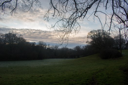
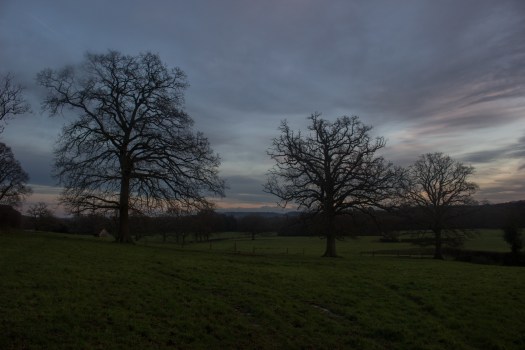
The top of the hill is managed by the National Trust and has been the successful subject of a scheme to regenerate the herb-rich grassland that makes the Downs famous – much of the hill having previously been ploughed up during the Second World War. The large open expanse of the hill affords wonderful views over to the coastal line of the Downs that stretches from Brighton to Eastbourne and in the summer it has one of the finest displays of wild orchids on these hills.

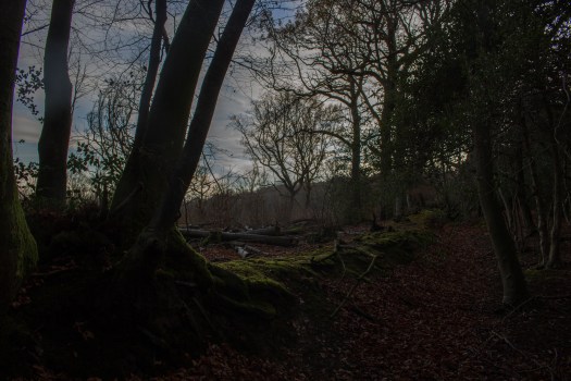
This is a hill that never fails to cheer me up. A network of bostalls scores its northern face, which allows the wanderer to assault it from various directions, or combine it with a walk in the woods and fields of the Low Weald at its feet.

IMG_5488

On my way up the hill today I spotted these King Alfred’s Cakes growing on a dead ash branch. The fungus gets its name, of course, from looking like burnt cakes, such as those supposedly neglected by King Alfred the Great while his mind was on other vaguely important things, like all those pesky Danes that were suddenly cluttering Wessex up. They only grow on dead ash and though they are extremely hard, they can be removed with a knife. Once they have been sliced off and the interior revealed, it can be seen that they have growth rings, just like the trees they grow on, which gives them their Latin name of Daldinia concentrica.

Long before the days of Alfred and his cakes, this fungus had another use. If a spark from a fire were blown onto the inner rings, it would smoulder quite slowly and happily away, even for days, until a new fire was to be set, at which point the addition of some dry tinder – and a fair amount of highly controlled blowing – would bring it back into a bright blaze. A very useful property in the days before we’d worked out how to make fire for ourselves and had to rely on its delivery from the Gods.

With the ash trees all dying of the Chalara fungus, they look set to have a bumper couple of decades, as there’s going to be plenty of dead ash for them to grow on. But after that, I suppose they’ll die out with their hosts. A sad end to such a wonderful part of our human past.

Henfield

On today’s walk I am, for once, actually in the Low Weald. Now, I have a tendency to think of the Low Weald as that bit of Sussex you have to drive across to get to more interesting places, but nevertheless off I set from Henfield down to the Adur (pronounced Ada) to see what I was missing out on. Which turns out to be badly waterlogged fields that proved once and for all that I need new boots. Again.

The Adur used to be navigable up as far as Knepp Castle (which is an interesting place in its own right), which always seems inconceivable considering how small the river is. Large vessels only ever came up as far as Steyning, though. These days they can’t get beyond Norfolk Bridge in Shoreham. The name of the river comes from the Roman fort Portus Adurni, which people in the 17th Century believed was in Shoreham. Turns out it was actually in Portchester, so only 37 miles out. Before it was called the Adur, it was known as the Bramber, after the village and castle, which is a much cuddlier name. Just to the west of Henfield the river divides into western and eastern branches, both of which remain tidal for some distance.

Also today I found some scary rogue ditches, the world’s most over-engineered bench and three cars that have been stuck end-on in the ground for some reason.

Dudwell Valley

Few villages in Sussex occupy a more enviable position than Burwash and its neighbour Burwash Weald sitting high up on one of the great east-west ridges of the eastern High Weald. In days past they must have been even more beautiful, before main roads and ranks of parked cars came along with all their ugly convenience. Burwash sits particularly prettily on its ridge and the buildings along the main road remain very handsome to this day. To the north runs the greatest of the three main rivers that run east to Rye Bay – the East Sussex Rother (not to be confused with the West Sussex Rother, itself a tributary of the Arun. Or the Yorkshire Rother, come to that). To the south is, to my mind, one of the most beautiful parts of the High Weald, if not of Sussex in general.

A small river, never much more than a large stream really, the Dudwell has nevertheless carved a deep, steep valley between the ridges occupied by the Burwashes to the north and Dallington and Brightling to the south. The acidity of the underlying sandstone is much in evidence here and many of the paths and tracks are bordered with hedges made of gorse. The impermeable layer of Wealden clay that covers it also makes its presence felt – the fields quickly becoming waterlogged and difficult to negotiate in wet weather.

The whole is covered with a patchwork of pasture and dense woodland, with many rushing, falling streams running among them. Scattered farms and oast houses perch on the hills and ridges between them, commanding wonderful views down the valley towards where the Dudwell finally reaches the Rother at Etchingham.

Penhurst

When first I arrived in Sussex I did what I always do in a new place, which is get in my car and start to explore. Driving out from Brighton along Ditchling Beacon Road, I soon found myself at the highest point in East Sussex, the Beacon itself, and what a view was laid out before me. Coming from Suffolk, which – beautiful though it is – is not known for its extensive vistas, it was amazing to stand on a point in the south east of England and be able to see so much country at my feet. Over time I would learn what I was looking at. I’d know which hills on the far horizon were part of the Greensand Ridge and which, seen only on the clearest days, were the North Downs away on the edges of London. I’d come to learn about the two Wealds – High and Low –  and how they were formed and I’d start a process of exploration, by foot and by car, that would lead to a truly abiding love for this wonderful corner of England.

Now, there are many beautiful places and areas in Sussex, of course, but the crowning glory of the county, to my mind, has to be the High Weald (there’s a whole High Weald article brewing) and probably the best part of that is the area around Penhurst and Brightling. I must have driven countless times along the lanes around there and paused in gateways, gazing out over the hills, the South Downs a faint shadow on the horizon; almost like a line of low cloud on the edge of consciousness.

This area is not like the eastern parts of the High Weald (which is a fascinating and beautiful region in its own right) with its long, wide, open valleys with high ridges between, topped by the villages so characteristic of the area. Those valleys were carved out by the bigger rivers which empty into Rye Bay – the Rother, the Brede and the Tillingham and their stories are long and intriguing ones, but there are other, smaller rivers and streams that have carved a web of deep, steep valleys into the sandstone rocks, creating a wonderfully complex landscape both secret and dramatic by turns.

Penhurst is a tiny, tiny village. A fine manor house, a church of honey-coloured local stone and a few barns and that’s pretty much it – the rest of this most rural of parishes being made up of scattered farms and cottages. It sits high among the headwaters of a small river that is named as the Ash Bourne on the OS map and which I have also seen referred to as the River Ashbourne in other places. This river doesn’t flow to the east, but almost due south until it leaves the steep valleys and rushing streams of its youth and becomes a slow, deep, winding river known as Waller’s Haven that snakes lazily across Pevensey Levels, before finding the sea via sluices at Norman’s Bay.

After all these years of driving through this wonderful little place, I am happy to have finally parked the car, got my boots on and done some of the real exploration that can only be done on foot.

Upper Medway

If you stand and look out from the higher points of Ashdown Forest in East Sussex, you are looking over successively younger landscapes the further your gaze falls from where you are standing. In an increasing, concentric horseshoe, the oldest rocks at the surface are the sandstones that form the hills of Ashdown Forest itself and the wider High Weald, followed by alternating areas of heavy Wealden clay, greensand ridges, so called because, it is claimed, this sandstone looks green when first exposed to the air, blueish gault clay that is almost as hard as rock and, finally, the chalk of the North and South Downs.

These old sandstones at the heart of the Weald give rise to several of Sussex’s rivers, including the greatest of them all, although its considerable claims to history are mostly based in the neighbouring county of Kent. It is possible that the Celts called the river “Medu”, which means “mead” and is assumed to refer to the sweetness of its waters. To the Romans the river was “Fluminus Meduwaeias”, while the Saxons called it the “Medwaeg”. At 70 miles, it is the longest river that rises in Sussex and the second longest in the South East of England, after the Thames.

The Medway is the only major river in Sussex that doesn’t flow towards the South Coast. (Apart from the Mole, but who cares about the Mole?) All the others eventually cut through the South Downs and empty into the English Channel, or flow into Rye Bay. The Medway, however, flows mostly eastwards through Sussex, before turning north and punching through the North Downs to finally enter the Thames Estuary. It is here that its best-known moments in history occur, being, as it was, the setting for the Royal Docks at Chatham. The Dutch Raid on the Medway of 1667 in particular is remembered as one of England’s most entertaining naval failures.

However, let us not get distracted by such frippery. Today my attention is turned to the upper catchment of the Medway, not far below its source at Turners Hill and all the while overlooking the great, modern reservoir known as Weir Wood, created by damming the river itself.

This is a landscape of steep, rushing streams and thickly wooded hills. The land being either sandy and poor or Wealden clay that is almost impermeable to water, agriculture is impractical here and the High Weald still retains the densest covering of woodland in the country. There are numerous outcroppings of the underlying sandstones here, such as at Stone Hill Rocks and Standen Rocks, among others. The bones of the earth being so on display seems almost out of keeping with the image of the South East of England as a “green and pleasant land”, but Sussex has always taken its own path and perhaps this almost secret world of steep narrow valleys and deep, dark woods has placed its influence on the peoples of this part of the world.

Harrow Hill

On their hundred-mile march from Winchester, the South Downs finally meet the sea at Brighton. Further east and the great, white ramparts of the Seven Sisters rear up and terminate in the tallest cliffs in the South East at Beachy Head. Further west, though, and the hills slowly pull away from the coast until even the dip-slope no longer reaches the shore. As they go, this gentler side of the Downs gains more space before finding itself cut off by the sea and the landscape becomes more complex as hills start to emerge, slowly carved out of the chalk by unimaginable amounts of water washing down from the melting glaciers. It is almost possible to stand on the top of the Downs and look over them, seeing the hills as islands in a great sea of meltwater.

From Chantry Post above Storrington you can see four of these hills. Furthest away to the east is Cissbury Ring, an enormous hill fort, then come Church Hill and Blackpatch Hill and finally Harrow Hill. The last of these is reputed to have been the last place in England occupied by fairies, but sadly it’s impossible to get close enough to check as there are no rights of way over it and one must be satisfied with merely walking around it.

There is much evidence of prehistoric life in these hills, with enclosures, cross dykes, strip-lynchets and hundreds of barrows all visible in the Downland turf. Before the Second World War, even more would have been visible, but the production of food in those desperate years became a need more pressing than the preservation of tumuli and much of the dip-slope was ploughed up for the first time, destroying an unknown amount of archaeology forever.

Lickfold

I admit I mainly wanted to walk in the Lickfold area because it’s got a funny name, but it also turns out to be in a really beautiful, rural part of Sussex.

Sitting in that bit of the county between Midhurst and Haslemere, it is comfortably within the boundary of the South Downs National Park, but this is not Downland. The bones of the earth, where they break through around here, are not white chalk, but sandstones that are far older than that. The great dark lump of Black Down looms in the distance, itself an outlier of the sandstone Surrey Hills, despite being the highest point in Sussex. The ground is spongy, sweet chestnut abounds in the woods and there are vast areas of commercial pine forest, while bracken fringes the edges of the woods and lanes. In fact this area, with its acid soils and rolling, thickly wooded hills, has much more in common with the High Weald than it does with the South Downs.

The villages are few and scattered and the houses often built out of the local stone, glowing honey-coloured in the weak December sun. This is one of the less-visited parts of the National Park and this is a big part of its glory. The paths are a little harder to follow in places, but still not difficult and there were some real moments of delicious solitude, while the surroundings alternated between deep, dark, secret woodland and wide open pastures.

There may be something in this business of choosing walks based on funny names after all. As a bonus the area also glories in the names “Dirty Bridge Barn” and “Dirty Bridge Field” (which is a wood, oddly). There didn’t seem to be an actual “Dirty Bridge”, though. Perhaps it’s too ashamed to bring attention to itself.


IMG_4410

A wood bank on the edge of Bexleyhill Common, with coppiced beech on the corner. Wood banks are ancient boundaries between properties and often have coppiced, stumped and pollarded trees on them to make them more obvious.

IMG_4417

Although this might look like a stand of dead trees, in fact it’s a plantation of larch – the only deciduous conifer – in its winter plumage.

IMG_4423

Definite signs of man-made channels in this meadow, silted up and barely discernible now, but the shallow, linear depressions in the deep grass show that this was once a water meadow and deliberately flooded to encourage lush growth. Just needs a lovely old red poll cow called Ermintrude to stand in the middle of it all and chew on a buttercup. A red poll? In Sussex? Sorry, that’s the Suffolk in me coming out.

IMG_4424

If you see a row of big old trees in a field like this, it’s very likely a sign that there used to be a hedgerow here. The rest of it’s been grubbed up for one reason or an other and only the big old oaks, too expensive and valuable to remove, remain to show us what once was.

IMG_4428

Although it looked quite scary in the gathering gloom and it was a bit slippery in the ice, this bridge doesn’t even make the top five Scariest Sussex Footbridges

Stane Street

If you turn at the beautiful old farm at Bignor and drive up the narrow road onto the Downs, you will find a lane so steep and winding that you will be forced to change down into first gear to get the car up there. I have made this climb many times, both by car and on foot, but what I didn’t realise until yesterday was that as you make the second steep turn, you join Stane Street, the Roman Road from London Bridge to the East Gate of Chichester.

Not only that, but the “agger” of the old road itself can be clearly seen at the top of the hill, where the tarmac gives out, but the ancient route continues.

Now, I’ve been up to Bignor Hill dozens of times and I’d noticed this long, linear earthwork and, in my ignorance, had assumed that it must be some kind of medieval boundary marker. It was only a bit of idle map-perusal that led me to realise that this bank of earth was, in fact, built by Roman engineers nearly 2000 years ago!

So, of course, armed with this new knowledge I set off for a proper look. Eschewing my usual route along the edge of the scarp (which is beautiful), the old Road was easy to follow and, as it emerged from some trees it stretched so obviously ahead of me, towards Chichester I could scarcely believe it. As I walked back along the bank I’d seen before I couldn’t get over how clearly this was a road, now I’d seen it in the right way.

What a wonderful thing that a place one knows so well can turn out to have something so completely unexpected and exciting as this!

Gravetye Estate

What a find! The estate of the Elizabethan former manor house of 1598, the whole lot was left to the Forestry Commission on the death of former owner William Robinson, who also created renowned gardens around the house, which are now open under restrictions. The house became a hotel and Michelin starred restaurant.

Because the estate is managed by the Forestry Commission, the whole lot is designated as Access Land and the public have the right to roam across all of it. Unlike most Forestry Commission properties it is far from being uniform pine plantation, but is in fact a wonderful extensive patchwork of woods, fields, lakes and streams laid over rolling hills and with the old manor house still set at its heart.

Wester Ross

I have been to many beautiful places and there are those that equal, but none that surpass Wester Ross in the Scottish West Highlands for sheer beauty and grandeur. There may be bigger mountains in the world, the weather may be a bit tricky and the midges can be a challenge, but there’s nowhere quite like it. If you love walking in the hills, dramatic mountain and coastal scenery and some of the best seafood in the world, I urge you to go there.